Świedziebnia geodata
Świedziebnia (Kujawsko-Pomorskie) is a seat of a third-order administrative division; located in Poland in Europe/Warsaw (GMT+2) time zone. With population of 958 people, there are 2583 cities with bigger population in this country. Compared to other cities in Poland, 85.7% of cities are located further ↓South; 50.2% of cities are located further →East and 63.7% of cities have higher elevation than Świedziebnia. Note1
Administrative division(s):
- Level 1: Kujawsko-Pomorskie
- Level 2: Powiat brodnicki
- Level 3: Świedziebnia


Świedziebnia GPS coordinates[2]
53° 9' 7.452" North, 19° 33' 16.668" East
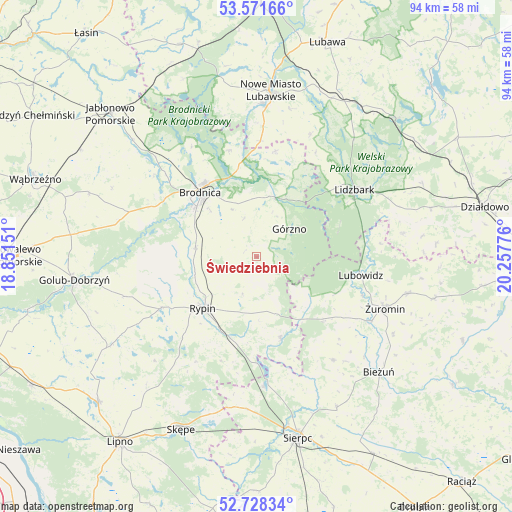
| Map corner | latitude | longitude |
|---|---|---|
| Upper-left | 53.57166°, | 18.85151° |
| Center: | 53.15207°, | 19.55463° |
| Lower-right: | 52.72834°, | 20.25776° |
| Map W x H: | 93.8×93.8 km | = 58.3×58.3mi |
| max Lat: | 54.83135° ⇑14.3% North |
| Świedziebnia: | 53.15207° |
| min Lat: | ⇓85.7% South 49.21328° |
| min Long | Świedziebnia | max Long |
| 14.20249° | 19.55463° | 24.03723° |
| W 49.8%⇐ | ⇒50.2% E |
Elevation
Elevation of Świedziebnia is 137 m = 449 ft, and this is 54.4 m = 178 ft below average elevation for this country.
| Max E: |
974 m = 3196 ft | 63.7% |
| Avg. | 191.4 m = 628 ft | |
| Świedziebnia | 137 m = 449 ft | |
Min E: |
-3 m = -10 ft | 36.3% |
See also: Poland elevation on elevation.city.
Geographical zone
Świedziebnia is located in North temperate zone (between Tropic of Cancer and the Arctic Circle). Distance of this North polar circle is 1491.2 km =926.6 mi to North.| Distance of | km | miles | from Świedziebnia |
|---|---|---|---|
| North Pole | 4097.1 | 2545.8 | to North |
| Arctic Circle | 1491.2 | 926.6 | to North |
| Tropic Cancer | 3304 | 2053 | to South |
| Equator | 5910 | 3672.3 | to South |


Nearby cities:
15 places around Świedziebnia: (largest is in red/bold)
• Bartniczka
11.1 km =6.9 mi,  17°
17°
• Brodnica
15.9 km =9.9 mi,  318°
318°
• Brzozie
19.6 km =12.2 mi,  9°
9°
• Brzozie Lubawskie
21.3 km =13.2 mi,  1°
1°
• Brzuze
22.3 km =13.9 mi,  240°
240°
• Górzno
7.8 km =4.8 mi,  49°
49°
• Janowo
2 km =1.2 mi,  126°
126°
• Lidzbark
21.9 km =13.6 mi,  55°
55°
• Lubowidz
19.8 km =12.3 mi,  100°
100°
• Osiek
11.4 km =7.1 mi,  279°
279°
• Ostrowite
19.7 km =12.2 mi, 242°
• Rogowo
22.5 km =14 mi,  210°
210°
• Rypin
13.6 km =8.5 mi,  225°
225°
• Skrwilno
15.8 km =9.8 mi,  163°
163°
• Wąpielsk
18.5 km =11.5 mi,  265°
265°
Sources, notices
• [Note1] Compared only with cities in Poland existing in our database
• [Src1] Map data: © OpenStreetMap contributors (CC-BY-SA)
• [Src2] Other city data from geonames.org with taken over terms of usage.
• [Src3] Geographical zone / Annual Mean Temperature by Robert A. Rohde @ Wikipedia
