Sokolniki geodata
Sokolniki (Łódź Voivodeship) is a seat of a third-order administrative division; located in Poland in Europe/Warsaw (GMT+2) time zone. With population of 1,200 people, there are 2164 cities with bigger population in this country. Compared to other cities in Poland, 53.3% of cities are located further ↓South; 70.7% of cities are located further →East and 53.5% of cities have lower elevation than Sokolniki. Note1
Administrative division(s):
- Level 1: Łódź Voivodeship
- Level 2: Powiat wieruszowski
- Level 3: Sokolniki


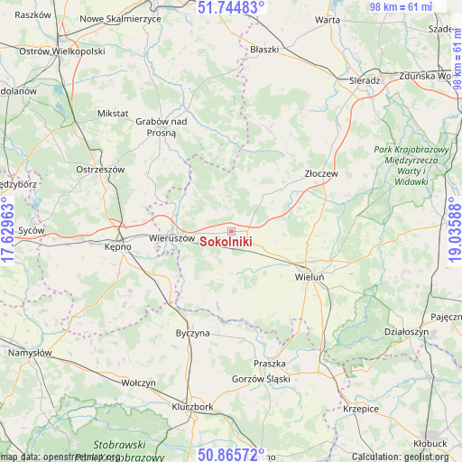
Sokolniki GPS coordinates[2]
51° 18' 26.568" North, 18° 19' 57.9" East
| Map corner | latitude | longitude |
|---|---|---|
| Upper-left | 51.74483°, | 17.62963° |
| Center: | 51.30738°, | 18.33275° |
| Lower-right: | 50.86572°, | 19.03588° |
| Map W x H: | 97.7×97.7 km | = 60.7×60.7mi |
| max Lat: | 54.83135° ⇑46.7% North |
| Sokolniki: | 51.30738° |
| min Lat: | ⇓53.3% South 49.21328° |
| min Long | Sokolniki | max Long |
| 14.20249° | 18.33275° | 24.03723° |
| W 29.3%⇐ | ⇒70.7% E |
Elevation
Elevation of Sokolniki is 181 m = 594 ft, and this is 10.4 m = 34 ft below average elevation for this country.
| Max E: |
974 m = 3196 ft | 46.5% |
| Avg. | 191.4 m = 628 ft | |
| Sokolniki | 181 m = 594 ft | |
Min E: |
-3 m = -10 ft | 53.5% |
See also: Poland elevation on elevation.city.
Geographical zone
Sokolniki is located in North temperate zone (between Tropic of Cancer and the Arctic Circle). Distance of this North polar circle is 1696.3 km =1054 mi to North.| Distance of | km | miles | from Sokolniki |
|---|---|---|---|
| North Pole | 4302.2 | 2673.3 | to North |
| Arctic Circle | 1696.3 | 1054 | to North |
| Tropic Cancer | 3098.9 | 1925.6 | to South |
| Equator | 5704.8 | 3544.8 | to South |


Nearby cities:
15 places around Sokolniki: (largest is in red/bold)
• Bolesławiec
15.6 km =9.7 mi,  219°
219°
• Czarnożyły
16.1 km =10 mi,  98°
98°
• Czastary
5.5 km =3.4 mi,  189°
189°
• Dzietrzkowice
16.6 km =10.3 mi,  181°
181°
• Galewice
6.7 km =4.2 mi,  308°
308°
• Klonowa
13.8 km =8.6 mi,  25°
25°
• Lututów
10 km =6.2 mi,  45°
45°
• Mieleszyn
11.5 km =7.1 mi,  230°
230°
• Mokrsko
17.9 km =11.1 mi,  142°
142°
• Opatów
16.6 km =10.3 mi, 231°
• Osiek
11.4 km =7.1 mi, 305°
• Skomlin
15.6 km =9.7 mi,  166°
166°
• Walichnowy
3.6 km =2.2 mi,  111°
111°
• Wieruszów
12.4 km =7.7 mi,  263°
263°
• Łubnice
16.2 km =10.1 mi, 190°
Sources, notices
• [Note1] Compared only with cities in Poland existing in our database
• [Src1] Map data: © OpenStreetMap contributors (CC-BY-SA)
• [Src2] Other city data from geonames.org with taken over terms of usage.
• [Src3] Geographical zone / Annual Mean Temperature by Robert A. Rohde @ Wikipedia
