Opatów geodata
Opatów (Greater Poland) is a populated place; located in Poland in Europe/Warsaw (GMT+2) time zone. With population of 1,200 people, there are 2164 cities with bigger population in this country. Compared to other cities in Poland, 51.2% of cities are located further ↓South; 73.6% of cities are located further →East and 51.9% of cities have higher elevation than Opatów. Note1
Administrative division(s):
- Level 1: Greater Poland
- Level 2: Powiat kępiński
- Level 3: Łęka Opatowska


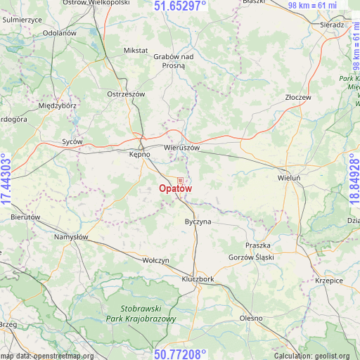
Opatów GPS coordinates[2]
51° 12' 52.668" North, 18° 8' 46.14" East
| Map corner | latitude | longitude |
|---|---|---|
| Upper-left | 51.65297°, | 17.44303° |
| Center: | 51.21463°, | 18.14615° |
| Lower-right: | 50.77208°, | 18.84928° |
| Map W x H: | 97.9×97.9 km | = 60.8×60.8mi |
| max Lat: | 54.83135° ⇑48.8% North |
| Opatów: | 51.21463° |
| min Lat: | ⇓51.2% South 49.21328° |
| min Long | Opatów | max Long |
| 14.20249° | 18.14615° | 24.03723° |
| W 26.4%⇐ | ⇒73.6% E |
Elevation
Elevation of Opatów is 167 m = 548 ft, and this is 24.4 m = 80 ft below average elevation for this country.
| Max E: |
974 m = 3196 ft | 51.9% |
| Avg. | 191.4 m = 628 ft | |
| Opatów | 167 m = 548 ft | |
Min E: |
-3 m = -10 ft | 48.1% |
See also: Poland elevation on elevation.city.
Geographical zone
Opatów is located in North temperate zone (between Tropic of Cancer and the Arctic Circle). Distance of this North polar circle is 1706.6 km =1060.4 mi to North.| Distance of | km | miles | from Opatów |
|---|---|---|---|
| North Pole | 4312.5 | 2679.7 | to North |
| Arctic Circle | 1706.6 | 1060.4 | to North |
| Tropic Cancer | 3088.6 | 1919.2 | to South |
| Equator | 5694.5 | 3538.4 | to South |


Nearby cities:
15 places around Opatów: (largest is in red/bold)
• Baranów
11.2 km =7 mi,  298°
298°
• Bolesławiec
3.6 km =2.2 mi,  119°
119°
• Byczyna
12.2 km =7.6 mi,  157°
157°
• Czastary
13 km =8.1 mi,  67°
67°
• Dzietrzkowice
14 km =8.7 mi, 116°
• Galewice
16.4 km =10.2 mi,  28°
28°
• Kępno
13 km =8.1 mi, 302°
• Mieleszyn
5.1 km =3.2 mi,  53°
53°
• Siemianice
3.9 km =2.4 mi,  183°
183°
• Słupia pod Kępnem
7.7 km =4.8 mi,  290°
290°
• Trzcinica
11.2 km =7 mi,  241°
241°
• Wielki Buczek
15.5 km =9.6 mi,  234°
234°
• Wieruszów
8.9 km =5.5 mi,  4°
4°
• Łubnice
11.5 km =7.1 mi, 119°
• Łęka Opatowska
2.7 km =1.7 mi,  264°
264°
Sources, notices
• [Note1] Compared only with cities in Poland existing in our database
• [Src1] Map data: © OpenStreetMap contributors (CC-BY-SA)
• [Src2] Other city data from geonames.org with taken over terms of usage.
• [Src3] Geographical zone / Annual Mean Temperature by Robert A. Rohde @ Wikipedia
