Galewice geodata
Galewice (Łódź Voivodeship) is a seat of a third-order administrative division; located in Poland in Europe/Warsaw (GMT+2) time zone. With population of 1,200 people, there are 2164 cities with bigger population in this country. Compared to other cities in Poland, 53.9% of cities are located further ↓South; 71.8% of cities are located further →East and 54.5% of cities have higher elevation than Galewice. Note1
Administrative division(s):
- Level 1: Łódź Voivodeship
- Level 2: Powiat wieruszowski
- Level 3: Galewice


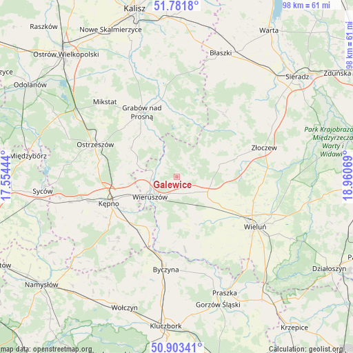
Galewice GPS coordinates[2]
51° 20' 40.956" North, 18° 15' 27.216" East
| Map corner | latitude | longitude |
|---|---|---|
| Upper-left | 51.7818°, | 17.55444° |
| Center: | 51.34471°, | 18.25756° |
| Lower-right: | 50.90341°, | 18.96069° |
| Map W x H: | 97.7×97.7 km | = 60.7×60.7mi |
| max Lat: | 54.83135° ⇑46.1% North |
| Galewice: | 51.34471° |
| min Lat: | ⇓53.9% South 49.21328° |
| min Long | Galewice | max Long |
| 14.20249° | 18.25756° | 24.03723° |
| W 28.2%⇐ | ⇒71.8% E |
Elevation
Elevation of Galewice is 160 m = 525 ft, and this is 31.4 m = 103 ft below average elevation for this country.
| Max E: |
974 m = 3196 ft | 54.5% |
| Avg. | 191.4 m = 628 ft | |
| Galewice | 160 m = 525 ft | |
Min E: |
-3 m = -10 ft | 45.5% |
See also: Poland elevation on elevation.city.
Geographical zone
Galewice is located in North temperate zone (between Tropic of Cancer and the Arctic Circle). Distance of this North polar circle is 1692.2 km =1051.5 mi to North.| Distance of | km | miles | from Galewice |
|---|---|---|---|
| North Pole | 4298.1 | 2670.7 | to North |
| Arctic Circle | 1692.2 | 1051.5 | to North |
| Tropic Cancer | 3103.1 | 1928.2 | to South |
| Equator | 5709 | 3547.4 | to South |


Nearby cities:
15 places around Galewice: (largest is in red/bold)
• Bolesławiec
16.9 km =10.5 mi,  195°
195°
• Czajków
17.1 km =10.6 mi,  16°
16°
• Czastary
10.5 km =6.5 mi,  155°
155°
• Doruchów
14.9 km =9.3 mi,  302°
302°
• Klonowa
13.9 km =8.6 mi,  53°
53°
• Kraszewice
19.5 km =12.1 mi,  352°
352°
• Lututów
12.6 km =7.8 mi,  76°
76°
• Mieleszyn
12 km =7.5 mi, 197°
• Opatów
16.4 km =10.2 mi,  208°
208°
• Osiek
4.8 km =3 mi, 302°
• Sokolniki
6.7 km =4.2 mi,  128°
128°
• Słupia pod Kępnem
19 km =11.8 mi,  231°
231°
• Walichnowy
10.1 km =6.3 mi,  122°
122°
• Wieruszów
9 km =5.6 mi, 232°
• Łęka Opatowska
18.1 km =11.2 mi,  215°
215°
Sources, notices
• [Note1] Compared only with cities in Poland existing in our database
• [Src1] Map data: © OpenStreetMap contributors (CC-BY-SA)
• [Src2] Other city data from geonames.org with taken over terms of usage.
• [Src3] Geographical zone / Annual Mean Temperature by Robert A. Rohde @ Wikipedia
