Ochaby geodata
Ochaby (Silesia) is a populated place; located in Poland in Europe/Warsaw (GMT+2) time zone. With population of 2,016 people, there are 1458 cities with bigger population in this country. Compared to other cities in Poland, 90.1% of cities are located further ↑North; 63.9% of cities are located further →East and 80.9% of cities have lower elevation than Ochaby. Note1


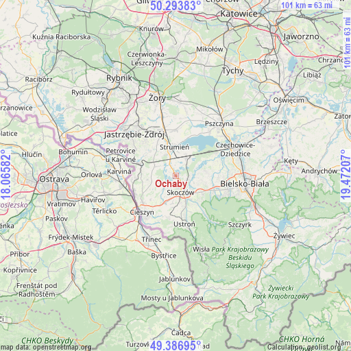
Ochaby GPS coordinates[2]
49° 50' 33.072" North, 18° 46' 8.184" East
| Map corner | latitude | longitude |
|---|---|---|
| Upper-left | 50.29383°, | 18.06582° |
| Center: | 49.84252°, | 18.76894° |
| Lower-right: | 49.38695°, | 19.47207° |
| Map W x H: | 100.8×100.8 km | = 62.6×62.6mi |
| max Lat: | 54.83135° ⇑90.1% North |
| Ochaby: | 49.84252° |
| min Lat: | ⇓9.9% South 49.21328° |
| min Long | Ochaby | max Long |
| 14.20249° | 18.76894° | 24.03723° |
| W 36.1%⇐ | ⇒63.9% E |
Elevation
Elevation of Ochaby is 269 m = 883 ft, and this is 77.6 m = 255 ft above average elevation for this country.
| Max E: |
974 m = 3196 ft | 19.1% |
| Ochaby | 269 m 883 ft | |
| Avg. | 191.4 m = 628 ft | |
Min E: |
-3 m = -10 ft | 80.9% |
See also: Poland elevation on elevation.city.
Geographical zone
Ochaby is located in North temperate zone (between Tropic of Cancer and the Arctic Circle). Distance of this North polar circle is 1859.2 km =1155.3 mi to North.| Distance of | km | miles | from Ochaby |
|---|---|---|---|
| North Pole | 4465.1 | 2774.5 | to North |
| Arctic Circle | 1859.2 | 1155.3 | to North |
| Tropic Cancer | 2936 | 1824.3 | to South |
| Equator | 5542 | 3443.6 | to South |


Nearby cities:
15 places around Ochaby: (largest is in red/bold)
• Bąków
6.9 km =4.3 mi,  325°
325°
• Drogomyśl
3.1 km =1.9 mi,  344°
344°
• Dębowiec
4.7 km =2.9 mi,  227°
227°
• Iskrzyczyn
5.5 km =3.4 mi,  199°
199°
• Kiczyce
3.1 km =1.9 mi,  129°
129°
• Kowale
5.4 km =3.4 mi,  109°
109°
• Miedzyświec
6.5 km =4 mi,  182°
182°
• Mnich
5.9 km =3.7 mi,  27°
27°
• Pierściec
3.4 km =2.1 mi, 107°
• Pruchna
6.7 km =4.2 mi,  292°
292°
• Simoradz
3.5 km =2.2 mi,  190°
190°
• Skoczów
4.8 km =3 mi,  163°
163°
• Wiślica
2.6 km =1.6 mi, 157°
• Zaborze
4.2 km =2.6 mi,  36°
36°
• Zabłocie
6.8 km =4.2 mi,  7°
7°
Sources, notices
• [Note1] Compared only with cities in Poland existing in our database
• [Src1] Map data: © OpenStreetMap contributors (CC-BY-SA)
• [Src2] Other city data from geonames.org with taken over terms of usage.
• [Src3] Geographical zone / Annual Mean Temperature by Robert A. Rohde @ Wikipedia
