Iskrzyczyn geodata
Iskrzyczyn (Silesia) is a populated place; located in Poland in Europe/Warsaw (GMT+2) time zone. With population of 646 people, there are 3178 cities with bigger population in this country. Compared to other cities in Poland, 91.9% of cities are located further ↑North; 64.4% of cities are located further →East and 91.4% of cities have lower elevation than Iskrzyczyn. Note1


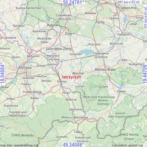
Iskrzyczyn GPS coordinates[2]
49° 47' 45.816" North, 18° 44' 38.256" East
| Map corner | latitude | longitude |
|---|---|---|
| Upper-left | 50.24781°, | 18.04084° |
| Center: | 49.79606°, | 18.74396° |
| Lower-right: | 49.34006°, | 19.44709° |
| Map W x H: | 100.9×100.9 km | = 62.7×62.7mi |
| max Lat: | 54.83135° ⇑91.9% North |
| Iskrzyczyn: | 49.79606° |
| min Lat: | ⇓8.1% South 49.21328° |
| min Long | Iskrzyczyn | max Long |
| 14.20249° | 18.74396° | 24.03723° |
| W 35.6%⇐ | ⇒64.4% E |
Elevation
Elevation of Iskrzyczyn is 348 m = 1142 ft, and this is 156.6 m = 514 ft above average elevation for this country.
| Max E: |
974 m = 3196 ft | 8.6% |
| Iskrzyczyn | 348 m 1142 ft | |
| Avg. | 191.4 m = 628 ft | |
Min E: |
-3 m = -10 ft | 91.4% |
See also: Poland elevation on elevation.city.
Geographical zone
Iskrzyczyn is located in North temperate zone (between Tropic of Cancer and the Arctic Circle). Distance of this North polar circle is 1864.4 km =1158.5 mi to North.| Distance of | km | miles | from Iskrzyczyn |
|---|---|---|---|
| North Pole | 4470.3 | 2777.7 | to North |
| Arctic Circle | 1864.4 | 1158.5 | to North |
| Tropic Cancer | 2930.9 | 1821.2 | to South |
| Equator | 5536.8 | 3440.4 | to South |


Nearby cities:
15 places around Iskrzyczyn: (largest is in red/bold)
• Bładnice
3.2 km =2 mi,  127°
127°
• Dębowiec
2.6 km =1.6 mi,  320°
320°
• Goleszów
6.7 km =4.2 mi,  184°
184°
• Górki Wielkie
6.5 km =4 mi,  106°
106°
• Harbutowice
5 km =3.1 mi, 111°
• Kiczyce
5.3 km =3.3 mi,  52°
52°
• Kostkowice
3.1 km =1.9 mi,  267°
267°
• Miedzyświec
2 km =1.2 mi, 131°
• Ochaby
5.5 km =3.4 mi,  19°
19°
• Ogrodzona
3.3 km =2.1 mi,  199°
199°
• Pierściec
6.5 km =4 mi, 50°
• Simoradz
2.1 km =1.3 mi,  33°
33°
• Skoczów
3.2 km =2 mi,  80°
80°
• Wiślica
4 km =2.5 mi, 45°
• Zamarski
5.5 km =3.4 mi,  254°
254°
Sources, notices
• [Note1] Compared only with cities in Poland existing in our database
• [Src1] Map data: © OpenStreetMap contributors (CC-BY-SA)
• [Src2] Other city data from geonames.org with taken over terms of usage.
• [Src3] Geographical zone / Annual Mean Temperature by Robert A. Rohde @ Wikipedia
