Nowe Miasto Lubawskie geodata
Nowe Miasto Lubawskie (Warmia-Masuria) is a populated place; located in Poland in Europe/Warsaw (GMT+2) time zone. With population of 10,997 people, there are 416 cities with bigger population in this country. Compared to other cities in Poland, 88.8% of cities are located further ↓South; 50.6% of cities are located further ←West and 87.2% of cities have higher elevation than Nowe Miasto Lubawskie. Note1
Administrative division(s):
- Level 1: Warmia-Masuria
- Level 2: Powiat nowomiejski
- Level 3: Nowe Miasto Lubawskie
Current local time in Nowe Miasto Lubawskie:
05:24 AM, SaturdayDifference from your time zone: hours


Nowe Miasto Lubawskie GPS coordinates[2]
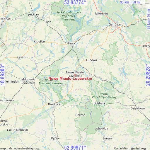
53° 25' 14.844" North, 19° 35' 42.54" East
| Map corner | latitude | longitude |
|---|---|---|
| Upper-left | 53.83774°, | 18.89203° |
| Center: | 53.42079°, | 19.59515° |
| Lower-right: | 52.99971°, | 20.29828° |
| Map W x H: | 93.2×93.2 km | = 57.9×57.9mi |
| max Lat: | 54.83135° ⇑11.2% North |
| Nowe Miasto Lubawskie: | 53.42079° |
| min Lat: | ⇓88.8% South 49.21328° |
| min Long | Nowe Miasto Lub | max Long |
| 14.20249° | 19.59515° | 24.03723° |
| W 50.6%⇐ | ⇒49.4% E |
Elevation
Elevation of Nowe Miasto Lubawskie is 84 m = 276 ft, and this is 107.4 m = 352 ft below average elevation for this country.
| Max E: |
974 m = 3196 ft | 87.2% |
| Avg. | 191.4 m = 628 ft | |
| Nowe Miasto Lubawskie | 84 m = 276 ft | |
Min E: |
-3 m = -10 ft | 12.8% |
See also: Poland elevation on elevation.city.
Geographical zone
Nowe Miasto Lubawskie is located in North temperate zone (between Tropic of Cancer and the Arctic Circle). Distance of this North polar circle is 1461.3 km =908 mi to North.| Distance of | km | miles | from Nowe Miasto Lubawskie |
|---|---|---|---|
| North Pole | 4067.2 | 2527.2 | to North |
| Arctic Circle | 1461.3 | 908 | to North |
| Tropic Cancer | 3333.9 | 2071.6 | to South |
| Equator | 5939.8 | 3690.8 | to South |


Nearby cities:
15 places around Nowe Miasto Lubawskie: (largest is in red/bold)
• Bartniczka
19.2 km =11.9 mi,  178°
178°
• Biskupiec
18.5 km =11.5 mi,  298°
298°
• Brodnica
22.2 km =13.8 mi,  216°
216°
• Brzozie
10.6 km =6.6 mi, 176°
• Brzozie Lubawskie
8.9 km =5.5 mi,  193°
193°
• Grabowo
21.6 km =13.4 mi,  43°
43°
• Grodziczno
11.1 km =6.9 mi,  94°
94°
• Iława
19.6 km =12.2 mi,  354°
354°
• Kurzętnik
2.7 km =1.7 mi,  203°
203°
• Lidzbark
23.3 km =14.5 mi,  138°
138°
• Lipinki
19.2 km =11.9 mi,  286°
286°
• Lubawa
13.8 km =8.6 mi,  47°
47°
• Ostrowite
21.3 km =13.2 mi,  269°
269°
• Rybno
22.7 km =14.1 mi,  100°
100°
• Zbiczno
17.5 km =10.9 mi,  236°
236°
Sources, notices
• [Note1] Compared only with cities in Poland existing in our database
• [Src1] Map data: © OpenStreetMap contributors (CC-BY-SA)
• [Src2] Other city data from geonames.org with taken over terms of usage.
• [Src3] Geographical zone / Annual Mean Temperature by Robert A. Rohde @ Wikipedia
