Lubawa geodata
Lubawa (Warmia-Masuria) is a seat of a third-order administrative division; located in Poland in Europe/Warsaw (GMT+2) time zone. With population of 9,302 people, there are 468 cities with bigger population in this country. Compared to other cities in Poland, 89.6% of cities are located further ↓South; 53.7% of cities are located further ←West and 62.1% of cities have higher elevation than Lubawa. Note1


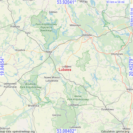
Lubawa GPS coordinates[2]
53° 30' 15.408" North, 19° 44' 58.776" East
| Map corner | latitude | longitude |
|---|---|---|
| Upper-left | 53.92041°, | 19.04654° |
| Center: | 53.50428°, | 19.74966° |
| Lower-right: | 53.08402°, | 20.45279° |
| Map W x H: | 93×93 km | = 57.8×57.8mi |
| max Lat: | 54.83135° ⇑10.4% North |
| Lubawa: | 53.50428° |
| min Lat: | ⇓89.6% South 49.21328° |
| min Long | Lubawa | max Long |
| 14.20249° | 19.74966° | 24.03723° |
| W 53.7%⇐ | ⇒46.3% E |
Elevation
Elevation of Lubawa is 142 m = 466 ft, and this is 49.4 m = 162 ft below average elevation for this country.
| Max E: |
974 m = 3196 ft | 62.1% |
| Avg. | 191.4 m = 628 ft | |
| Lubawa | 142 m = 466 ft | |
Min E: |
-3 m = -10 ft | 37.9% |
See also: Poland elevation on elevation.city.
Geographical zone
Lubawa is located in North temperate zone (between Tropic of Cancer and the Arctic Circle). Distance of this North polar circle is 1452.1 km =902.3 mi to North.| Distance of | km | miles | from Lubawa |
|---|---|---|---|
| North Pole | 4057.9 | 2521.5 | to North |
| Arctic Circle | 1452.1 | 902.3 | to North |
| Tropic Cancer | 3343.2 | 2077.4 | to South |
| Equator | 5949.1 | 3696.6 | to South |


Nearby cities:
15 places around Lubawa: (largest is in red/bold)
• Biskupiec
26.4 km =16.4 mi,  269°
269°
• Brzozie
22.1 km =13.7 mi,  205°
205°
• Brzozie Lubawskie
21.7 km =13.5 mi, 214°
• Dąbrówno
20.5 km =12.7 mi,  112°
112°
• Gierzwałd
22.8 km =14.2 mi,  79°
79°
• Grabowo
7.9 km =4.9 mi,  35°
35°
• Grodziczno
10.2 km =6.3 mi,  175°
175°
• Grunwald
22.9 km =14.2 mi,  95°
95°
• Iława
15.7 km =9.8 mi,  310°
310°
• Kurzętnik
16.3 km =10.1 mi,  223°
223°
• Lidzbark
27.3 km =17 mi,  169°
169°
• Lipinki
28.9 km =18 mi,  262°
262°
• Nowe Miasto Lubawskie
13.8 km =8.6 mi,  227°
227°
• Ostróda
25.7 km =16 mi,  33°
33°
• Rybno
18.1 km =11.2 mi,  137°
137°
Sources, notices
• [Note1] Compared only with cities in Poland existing in our database
• [Src1] Map data: © OpenStreetMap contributors (CC-BY-SA)
• [Src2] Other city data from geonames.org with taken over terms of usage.
• [Src3] Geographical zone / Annual Mean Temperature by Robert A. Rohde @ Wikipedia
