Grabowo geodata
Grabowo (Warmia-Masuria) is a populated place; located in Poland in Europe/Warsaw (GMT+2) time zone. With population of 615 people, there are 3241 cities with bigger population in this country. Compared to other cities in Poland, 90.3% of cities are located further ↓South; 55.2% of cities are located further ←West and 56.4% of cities have higher elevation than Grabowo. Note1


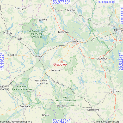
Grabowo GPS coordinates[2]
53° 33' 43.308" North, 19° 49' 9.624" East
| Map corner | latitude | longitude |
|---|---|---|
| Upper-left | 53.97759°, | 19.11622° |
| Center: | 53.56203°, | 19.81934° |
| Lower-right: | 53.14234°, | 20.52247° |
| Map W x H: | 92.9×92.9 km | = 57.7×57.7mi |
| max Lat: | 54.83135° ⇑9.7% North |
| Grabowo: | 53.56203° |
| min Lat: | ⇓90.3% South 49.21328° |
| min Long | Grabowo | max Long |
| 14.20249° | 19.81934° | 24.03723° |
| W 55.2%⇐ | ⇒44.8% E |
Elevation
Elevation of Grabowo is 155 m = 509 ft, and this is 36.4 m = 119 ft below average elevation for this country.
| Max E: |
974 m = 3196 ft | 56.4% |
| Avg. | 191.4 m = 628 ft | |
| Grabowo | 155 m = 509 ft | |
Min E: |
-3 m = -10 ft | 43.6% |
See also: Poland elevation on elevation.city.
Geographical zone
Grabowo is located in North temperate zone (between Tropic of Cancer and the Arctic Circle). Distance of this North polar circle is 1445.6 km =898.3 mi to North.| Distance of | km | miles | from Grabowo |
|---|---|---|---|
| North Pole | 4051.5 | 2517.5 | to North |
| Arctic Circle | 1445.6 | 898.3 | to North |
| Tropic Cancer | 3349.6 | 2081.3 | to South |
| Equator | 5955.5 | 3700.6 | to South |


Nearby cities:
15 places around Grabowo: (largest is in red/bold)
• Brzozie
29.9 km =18.6 mi,  208°
208°
• Brzozie Lubawskie
29.6 km =18.4 mi, 214°
• Dąbrówno
20.2 km =12.6 mi,  134°
134°
• Gierzwałd
17.9 km =11.1 mi,  97°
97°
• Grodziczno
17 km =10.6 mi,  193°
193°
• Grunwald
20.1 km =12.5 mi,  115°
115°
• Iława
17 km =10.6 mi,  282°
282°
• Kurzętnik
24.2 km =15 mi,  221°
221°
• Lubawa
7.9 km =4.9 mi, 215°
• Mielno
25.3 km =15.7 mi, 102°
• Miłomłyn
22.5 km =14 mi,  3°
3°
• Nowe Miasto Lubawskie
21.6 km =13.4 mi, 223°
• Olsztynek
30.8 km =19.1 mi,  85°
85°
• Ostróda
17.8 km =11.1 mi,  32°
32°
• Rybno
21.2 km =13.2 mi,  159°
159°
Sources, notices
• [Note1] Compared only with cities in Poland existing in our database
• [Src1] Map data: © OpenStreetMap contributors (CC-BY-SA)
• [Src2] Other city data from geonames.org with taken over terms of usage.
• [Src3] Geographical zone / Annual Mean Temperature by Robert A. Rohde @ Wikipedia
