Nędza geodata
Nędza (Silesia) is a seat of a third-order administrative division; located in Poland in Europe/Warsaw (GMT+2) time zone. With population of 3,344 people, there are 957 cities with bigger population in this country. Compared to other cities in Poland, 75.5% of cities are located further ↑North; 71.2% of cities are located further →East and 57.3% of cities have lower elevation than Nędza. Note1


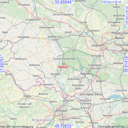
Nędza GPS coordinates[2]
50° 9' 40.032" North, 18° 18' 39.708" East
| Map corner | latitude | longitude |
|---|---|---|
| Upper-left | 50.60944°, | 17.60791° |
| Center: | 50.16112°, | 18.31103° |
| Lower-right: | 49.70855°, | 19.01416° |
| Map W x H: | 100.2×100.2 km | = 62.3×62.3mi |
| max Lat: | 54.83135° ⇑75.5% North |
| Nędza: | 50.16112° |
| min Lat: | ⇓24.5% South 49.21328° |
| min Long | Nędza | max Long |
| 14.20249° | 18.31103° | 24.03723° |
| W 28.8%⇐ | ⇒71.2% E |
Elevation
Elevation of Nędza is 191 m = 627 ft, and this is 0.40000000000001 m = 1 ft below average elevation for this country.
| Max E: |
974 m = 3196 ft | 42.7% |
| Avg. | 191.4 m = 628 ft | |
| Nędza | 191 m = 627 ft | |
Min E: |
-3 m = -10 ft | 57.3% |
See also: Poland elevation on elevation.city.
Geographical zone
Nędza is located in North temperate zone (between Tropic of Cancer and the Arctic Circle). Distance of this North polar circle is 1823.8 km =1133.3 mi to North.| Distance of | km | miles | from Nędza |
|---|---|---|---|
| North Pole | 4429.7 | 2752.5 | to North |
| Arctic Circle | 1823.8 | 1133.3 | to North |
| Tropic Cancer | 2971.5 | 1846.4 | to South |
| Equator | 5577.4 | 3465.6 | to South |


Nearby cities:
15 places around Nędza: (largest is in red/bold)
• Adamowice
3.6 km =2.2 mi,  154°
154°
• Babice
2.3 km =1.4 mi,  205°
205°
• Bogunice
4.8 km =3 mi,  121°
121°
• Brzeźnica
6.6 km =4.1 mi,  257°
257°
• Budziska
5.2 km =3.2 mi,  333°
333°
• Dziergowice
9.2 km =5.7 mi,  348°
348°
• Górki Śląskie
5.9 km =3.7 mi,  111°
111°
• Kobyła
7.7 km =4.8 mi,  183°
183°
• Kornowac
10 km =6.2 mi,  172°
172°
• Kuźnia Raciborska
4.4 km =2.7 mi,  0°
0°
• Lyski
7.3 km =4.5 mi,  128°
128°
• Racibórz
10.1 km =6.3 mi,  220°
220°
• Raszczyce
4.4 km =2.7 mi,  190°
190°
• Rudnik
9.7 km =6 mi,  247°
247°
• Turze
4.9 km =3 mi,  317°
317°
Sources, notices
• [Note1] Compared only with cities in Poland existing in our database
• [Src1] Map data: © OpenStreetMap contributors (CC-BY-SA)
• [Src2] Other city data from geonames.org with taken over terms of usage.
• [Src3] Geographical zone / Annual Mean Temperature by Robert A. Rohde @ Wikipedia
