Babice geodata
Babice (Silesia) is a populated place; located in Poland in Europe/Warsaw (GMT+2) time zone. With population of 864 people, there are 2740 cities with bigger population in this country. Compared to other cities in Poland, 76.4% of cities are located further ↑North; 71.4% of cities are located further →East and 61% of cities have lower elevation than Babice. Note1


Babice GPS coordinates[2]
50° 8' 33.72" North, 18° 17' 50.28" East
| Map corner | latitude | longitude |
|---|---|---|
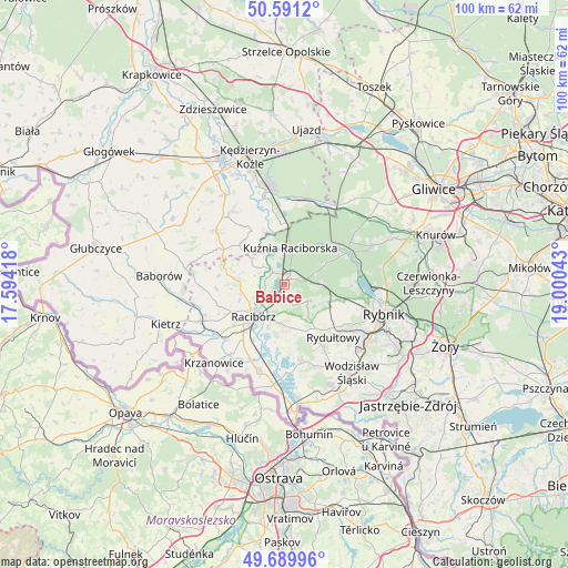
| Upper-left | 50.5912°, | 17.59418° |
| Center: | 50.1427°, | 18.2973° |
| Lower-right: | 49.68996°, | 19.00043° |
| Map W x H: | 100.2×100.2 km | = 62.3×62.3mi |
| max Lat: | 54.83135° ⇑76.4% North |
| Babice: | 50.1427° |
| min Lat: | ⇓23.6% South 49.21328° |
| min Long | Babice | max Long |
| 14.20249° | 18.2973° | 24.03723° |
| W 28.6%⇐ | ⇒71.4% E |
Elevation
Elevation of Babice is 203 m = 666 ft, and this is 11.6 m = 38 ft above average elevation for this country.
| Max E: |
974 m = 3196 ft | 39% |
| Babice | 203 m 666 ft | |
| Avg. | 191.4 m = 628 ft | |
Min E: |
-3 m = -10 ft | 61% |
See also: Poland elevation on elevation.city.
Geographical zone
Babice is located in North temperate zone (between Tropic of Cancer and the Arctic Circle). Distance of this North polar circle is 1825.8 km =1134.5 mi to North.| Distance of | km | miles | from Babice |
|---|---|---|---|
| North Pole | 4431.7 | 2753.7 | to North |
| Arctic Circle | 1825.8 | 1134.5 | to North |
| Tropic Cancer | 2969.4 | 1845.1 | to South |
| Equator | 5575.3 | 3464.3 | to South |


Nearby cities:
15 places around Babice: (largest is in red/bold)
• Adamowice
2.8 km =1.7 mi,  115°
115°
• Bogunice
5.1 km =3.2 mi,  95°
95°
• Brzeźnica
5.4 km =3.4 mi,  276°
276°
• Budziska
6.9 km =4.3 mi,  348°
348°
• Górki Śląskie
6.4 km =4 mi,  91°
91°
• Kobyła
5.6 km =3.5 mi,  174°
174°
• Kornowac
8.2 km =5.1 mi,  164°
164°
• Kuźnia Raciborska
6.5 km =4 mi,  8°
8°
• Lyski
7.2 km =4.5 mi,  110°
110°
• Nędza
2.3 km =1.4 mi,  25°
25°
• Pogrzebień
8.4 km =5.2 mi,  179°
179°
• Racibórz
7.9 km =4.9 mi,  224°
224°
• Raszczyce
2.3 km =1.4 mi, 175°
• Rudnik
8.1 km =5 mi,  257°
257°
• Turze
6.1 km =3.8 mi,  337°
337°
Sources, notices
• [Note1] Compared only with cities in Poland existing in our database
• [Src1] Map data: © OpenStreetMap contributors (CC-BY-SA)
• [Src2] Other city data from geonames.org with taken over terms of usage.
• [Src3] Geographical zone / Annual Mean Temperature by Robert A. Rohde @ Wikipedia
