Międzylesie geodata
Międzylesie (Lubusz) is a populated place; located in Poland in Europe/Warsaw (GMT+2) time zone. With population of 1,971 people, there are 1511 cities with bigger population in this country. Compared to other cities in Poland, 68.8% of cities are located further ↓South; 96.2% of cities are located further →East and 88.4% of cities have higher elevation than Międzylesie. Note1


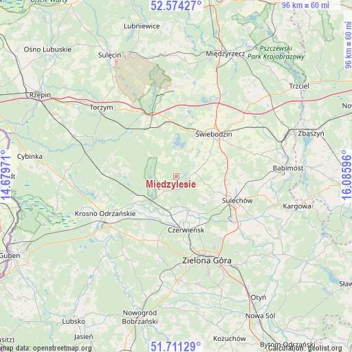
Międzylesie GPS coordinates[2]
52° 8' 41.532" North, 15° 22' 58.188" East
| Map corner | latitude | longitude |
|---|---|---|
| Upper-left | 52.57427°, | 14.67971° |
| Center: | 52.14487°, | 15.38283° |
| Lower-right: | 51.71129°, | 16.08596° |
| Map W x H: | 96×96 km | = 59.7×59.7mi |
| max Lat: | 54.83135° ⇑31.2% North |
| Międzylesie: | 52.14487° |
| min Lat: | ⇓68.8% South 49.21328° |
| min Long | Międzylesie | max Long |
| 14.20249° | 15.38283° | 24.03723° |
| W 3.8%⇐ | ⇒96.2% E |
Elevation
Elevation of Międzylesie is 80 m = 262 ft, and this is 111.4 m = 365 ft below average elevation for this country.
| Max E: |
974 m = 3196 ft | 88.4% |
| Avg. | 191.4 m = 628 ft | |
| Międzylesie | 80 m = 262 ft | |
Min E: |
-3 m = -10 ft | 11.6% |
See also: Poland elevation on elevation.city.
Geographical zone
Międzylesie is located in North temperate zone (between Tropic of Cancer and the Arctic Circle). Distance of this North polar circle is 1603.2 km =996.2 mi to North.| Distance of | km | miles | from Międzylesie |
|---|---|---|---|
| North Pole | 4209.1 | 2615.4 | to North |
| Arctic Circle | 1603.2 | 996.2 | to North |
| Tropic Cancer | 3192 | 1983.4 | to South |
| Equator | 5798 | 3602.7 | to South |


Nearby cities:
15 places around Międzylesie: (largest is in red/bold)
• Brody
10 km =6.2 mi,  159°
159°
• Bytnica
14.6 km =9.1 mi,  272°
272°
• Cigacice
19.8 km =12.3 mi,  127°
127°
• Czerwieńsk
14.9 km =9.3 mi,  169°
169°
• Dąbie
21.7 km =13.5 mi,  226°
226°
• Kije
12 km =7.5 mi,  115°
115°
• Krosno Odrzańskie
21.8 km =13.5 mi,  242°
242°
• Lubrza
18.2 km =11.3 mi,  13°
13°
• Osiecznica
23.9 km =14.9 mi,  251°
251°
• Ploty
17.8 km =11.1 mi, 173°
• Skąpe
5.2 km =3.2 mi,  80°
80°
• Sulechów
17.9 km =11.1 mi,  112°
112°
• Wilkowo
13.5 km =8.4 mi,  25°
25°
• Łagów
21.8 km =13.5 mi,  344°
344°
• Świebodzin
15.4 km =9.6 mi,  41°
41°
Sources, notices
• [Note1] Compared only with cities in Poland existing in our database
• [Src1] Map data: © OpenStreetMap contributors (CC-BY-SA)
• [Src2] Other city data from geonames.org with taken over terms of usage.
• [Src3] Geographical zone / Annual Mean Temperature by Robert A. Rohde @ Wikipedia
