Masłowice geodata
Masłowice (Łódź Voivodeship) is a populated place; located in Poland in Europe/Warsaw (GMT+2) time zone. With population of 759 people, there are 2937 cities with bigger population in this country. Compared to other cities in Poland, 52.3% of cities are located further ↓South; 65.9% of cities are located further →East and 51.3% of cities have higher elevation than Masłowice. Note1


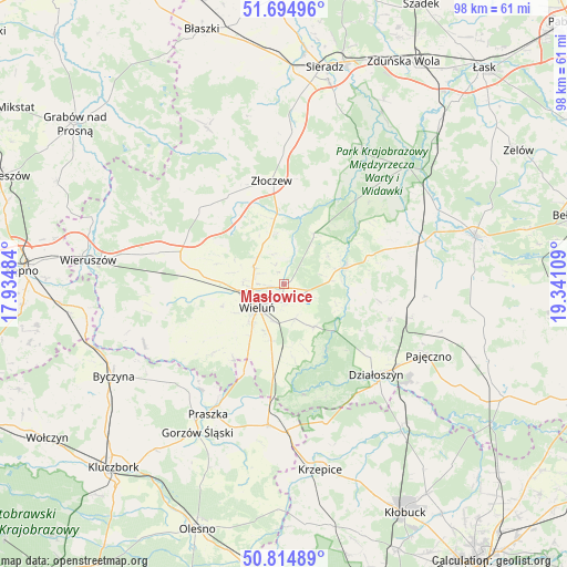
Masłowice GPS coordinates[2]
51° 15' 25.308" North, 18° 38' 16.656" East
| Map corner | latitude | longitude |
|---|---|---|
| Upper-left | 51.69496°, | 17.93484° |
| Center: | 51.25703°, | 18.63796° |
| Lower-right: | 50.81489°, | 19.34109° |
| Map W x H: | 97.9×97.9 km | = 60.8×60.8mi |
| max Lat: | 54.83135° ⇑47.7% North |
| Masłowice: | 51.25703° |
| min Lat: | ⇓52.3% South 49.21328° |
| min Long | Masłowice | max Long |
| 14.20249° | 18.63796° | 24.03723° |
| W 34.1%⇐ | ⇒65.9% E |
Elevation
Elevation of Masłowice is 169 m = 554 ft, and this is 22.4 m = 73 ft below average elevation for this country.
| Max E: |
974 m = 3196 ft | 51.3% |
| Avg. | 191.4 m = 628 ft | |
| Masłowice | 169 m = 554 ft | |
Min E: |
-3 m = -10 ft | 48.7% |
See also: Poland elevation on elevation.city.
Geographical zone
Masłowice is located in North temperate zone (between Tropic of Cancer and the Arctic Circle). Distance of this North polar circle is 1701.9 km =1057.5 mi to North.| Distance of | km | miles | from Masłowice |
|---|---|---|---|
| North Pole | 4307.8 | 2676.7 | to North |
| Arctic Circle | 1701.9 | 1057.5 | to North |
| Tropic Cancer | 3093.3 | 1922.1 | to South |
| Equator | 5699.2 | 3541.3 | to South |


Nearby cities:
15 places around Masłowice: (largest is in red/bold)
• Czarnożyły
6.2 km =3.9 mi,  300°
300°
• Konopnica
16.8 km =10.4 mi,  50°
50°
• Lipnik
16.3 km =10.1 mi,  99°
99°
• Lututów
18.9 km =11.7 mi,  311°
311°
• Mokrsko
13.5 km =8.4 mi,  230°
230°
• Osjaków
11.3 km =7 mi,  71°
71°
• Ostrówek
8.9 km =5.5 mi,  353°
353°
• Ożarów
15.3 km =9.5 mi,  215°
215°
• Pątnów
12.7 km =7.9 mi,  186°
186°
• Siemkowice
19.2 km =11.9 mi,  108°
108°
• Skomlin
19.9 km =12.4 mi,  241°
241°
• Walichnowy
18.4 km =11.4 mi,  283°
283°
• Wieluń
6.2 km =3.9 mi, 229°
• Wierzchlas
6.1 km =3.8 mi,  161°
161°
• Złoczew
18 km =11.2 mi, 352°
Sources, notices
• [Note1] Compared only with cities in Poland existing in our database
• [Src1] Map data: © OpenStreetMap contributors (CC-BY-SA)
• [Src2] Other city data from geonames.org with taken over terms of usage.
• [Src3] Geographical zone / Annual Mean Temperature by Robert A. Rohde @ Wikipedia
