Lipnik geodata
Lipnik (Łódź Voivodeship) is a populated place; located in Poland in Europe/Warsaw (GMT+2) time zone. With population of 653 people, there are 3158 cities with bigger population in this country. Compared to other cities in Poland, 51.7% of cities are located further ↓South; 62.4% of cities are located further →East and 50.2% of cities have higher elevation than Lipnik. Note1
Administrative division(s):
- Level 1: Łódź Voivodeship
- Level 2: Powiat pajęczański
- Level 3: Siemkowice


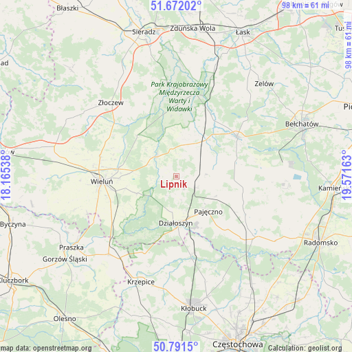
Lipnik GPS coordinates[2]
51° 14' 1.932" North, 18° 52' 6.6" East
| Map corner | latitude | longitude |
|---|---|---|
| Upper-left | 51.67202°, | 18.16538° |
| Center: | 51.23387°, | 18.8685° |
| Lower-right: | 50.7915°, | 19.57163° |
| Map W x H: | 97.9×97.9 km | = 60.8×60.8mi |
| max Lat: | 54.83135° ⇑48.3% North |
| Lipnik: | 51.23387° |
| min Lat: | ⇓51.7% South 49.21328° |
| min Long | Lipnik | max Long |
| 14.20249° | 18.8685° | 24.03723° |
| W 37.6%⇐ | ⇒62.4% E |
Elevation
Elevation of Lipnik is 171 m = 561 ft, and this is 20.4 m = 67 ft below average elevation for this country.
| Max E: |
974 m = 3196 ft | 50.2% |
| Avg. | 191.4 m = 628 ft | |
| Lipnik | 171 m = 561 ft | |
Min E: |
-3 m = -10 ft | 49.8% |
See also: Poland elevation on elevation.city.
Geographical zone
Lipnik is located in North temperate zone (between Tropic of Cancer and the Arctic Circle). Distance of this North polar circle is 1704.5 km =1059.1 mi to North.| Distance of | km | miles | from Lipnik |
|---|---|---|---|
| North Pole | 4310.4 | 2678.4 | to North |
| Arctic Circle | 1704.5 | 1059.1 | to North |
| Tropic Cancer | 3090.8 | 1920.5 | to South |
| Equator | 5696.7 | 3539.8 | to South |


Nearby cities:
15 places around Lipnik: (largest is in red/bold)
• Działoszyn
13 km =8.1 mi,  181°
181°
• Kiełczygłów
8 km =5 mi,  86°
86°
• Konopnica
13.7 km =8.5 mi,  346°
346°
• Masłowice
16.3 km =10.1 mi,  279°
279°
• Osjaków
8.2 km =5.1 mi,  319°
319°
• Ostrówek
20.5 km =12.7 mi,  303°
303°
• Pajęczno
13.3 km =8.3 mi,  138°
138°
• Pątnów
20.2 km =12.6 mi,  240°
240°
• Rusiec
12.9 km =8 mi,  38°
38°
• Rząśnia
12.3 km =7.6 mi,  96°
96°
• Siemkowice
4.1 km =2.5 mi,  149°
149°
• Strzelce Wielkie
22 km =13.7 mi,  118°
118°
• Szczerców
20.1 km =12.5 mi,  56°
56°
• Wieluń
20.9 km =13 mi,  266°
266°
• Wierzchlas
14.5 km =9 mi,  257°
257°
Sources, notices
• [Note1] Compared only with cities in Poland existing in our database
• [Src1] Map data: © OpenStreetMap contributors (CC-BY-SA)
• [Src2] Other city data from geonames.org with taken over terms of usage.
• [Src3] Geographical zone / Annual Mean Temperature by Robert A. Rohde @ Wikipedia
