Łeba geodata
Łeba (Pomerania) is a populated place; located in Poland in Europe/Warsaw (GMT+2) time zone. With population of 3,744 people, there are 867 cities with bigger population in this country. Compared to other cities in Poland, 99.8% of cities are located further ↓South; 79.5% of cities are located further →East and 99.8% of cities have higher elevation than Łeba. Note1


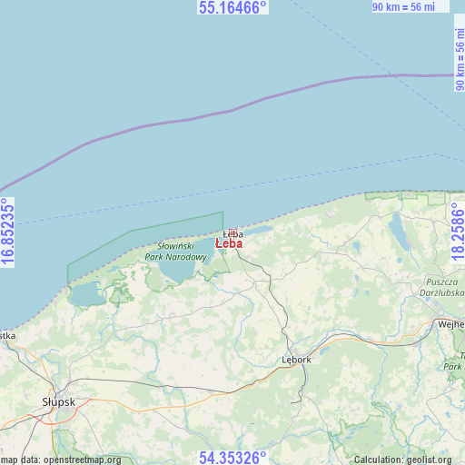
Łeba GPS coordinates[2]
54° 45' 39.564" North, 17° 33' 19.692" East
| Map corner | latitude | longitude |
|---|---|---|
| Upper-left | 55.16466°, | 16.85235° |
| Center: | 54.76099°, | 17.55547° |
| Lower-right: | 54.35326°, | 18.2586° |
| Map W x H: | 90.2×90.2 km | = 56×56mi |
| max Lat: | 54.83135° ⇑0.2% North |
| Łeba: | 54.76099° |
| min Lat: | ⇓99.8% South 49.21328° |
| min Long | Łeba | max Long |
| 14.20249° | 17.55547° | 24.03723° |
| W 20.5%⇐ | ⇒79.5% E |
Elevation
Elevation of Łeba is 1 m = 3 ft, and this is 190.4 m = 625 ft below average elevation for this country.
| Max E: |
974 m = 3196 ft | 99.8% |
| Avg. | 191.4 m = 628 ft | |
| Łeba | 1 m = 3 ft | |
Min E: |
-3 m = -10 ft | 0.2% |
See also: Poland elevation on elevation.city.
Geographical zone
Łeba is located in North temperate zone (between Tropic of Cancer and the Arctic Circle). Distance of this North polar circle is 1312.3 km =815.4 mi to North.| Distance of | km | miles | from Łeba |
|---|---|---|---|
| North Pole | 3918.2 | 2434.7 | to North |
| Arctic Circle | 1312.3 | 815.4 | to North |
| Tropic Cancer | 3482.9 | 2164.2 | to South |
| Equator | 6088.9 | 3783.5 | to South |


Nearby cities:
15 places around Łeba: (largest is in red/bold)
• Bobrowniki
29.7 km =18.5 mi,  208°
208°
• Choczewo
21.7 km =13.5 mi,  96°
96°
• Damnica
34.3 km =21.3 mi, 212°
• Gniewino
30 km =18.6 mi, 99°
• Główczyce
19.7 km =12.2 mi,  216°
216°
• Lębork
27.7 km =17.2 mi,  153°
153°
• Maszewo Lęborskie
34.3 km =21.3 mi,  160°
160°
• Nowa Wieś Lęborska
25.1 km =15.6 mi, 153°
• Objazda
37.1 km =23.1 mi,  242°
242°
• Potęgowo
31.2 km =19.4 mi,  188°
188°
• Rybno
35.1 km =21.8 mi, 104°
• Smołdzino
24.5 km =15.2 mi, 243°
• Wicko
10.8 km =6.7 mi, 158°
• Wierzchucino
28.9 km =18 mi,  84°
84°
• Łęczyce
26.9 km =16.7 mi,  133°
133°
Sources, notices
• [Note1] Compared only with cities in Poland existing in our database
• [Src1] Map data: © OpenStreetMap contributors (CC-BY-SA)
• [Src2] Other city data from geonames.org with taken over terms of usage.
• [Src3] Geographical zone / Annual Mean Temperature by Robert A. Rohde @ Wikipedia
