Kiszkowo geodata
Kiszkowo (Greater Poland) is a seat of a third-order administrative division; located in Poland in Europe/Warsaw (GMT+2) time zone. With population of 1,893 people, there are 1565 cities with bigger population in this country. Compared to other cities in Poland, 77.8% of cities are located further ↓South; 81.7% of cities are located further →East and 82.7% of cities have higher elevation than Kiszkowo. Note1


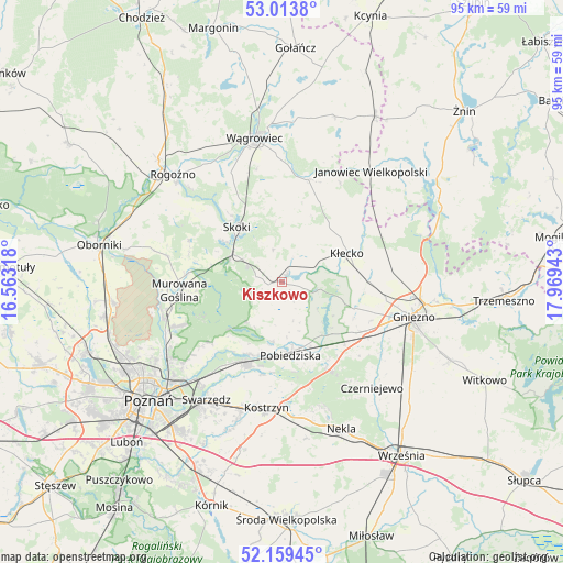
Kiszkowo GPS coordinates[2]
52° 35' 19.356" North, 17° 15' 58.68" East
| Map corner | latitude | longitude |
|---|---|---|
| Upper-left | 53.0138°, | 16.56318° |
| Center: | 52.58871°, | 17.2663° |
| Lower-right: | 52.15945°, | 17.96943° |
| Map W x H: | 95×95 km | = 59×59mi |
| max Lat: | 54.83135° ⇑22.2% North |
| Kiszkowo: | 52.58871° |
| min Lat: | ⇓77.8% South 49.21328° |
| min Long | Kiszkowo | max Long |
| 14.20249° | 17.2663° | 24.03723° |
| W 18.3%⇐ | ⇒81.7% E |
Elevation
Elevation of Kiszkowo is 94 m = 308 ft, and this is 97.4 m = 320 ft below average elevation for this country.
| Max E: |
974 m = 3196 ft | 82.7% |
| Avg. | 191.4 m = 628 ft | |
| Kiszkowo | 94 m = 308 ft | |
Min E: |
-3 m = -10 ft | 17.3% |
See also: Poland elevation on elevation.city.
Geographical zone
Kiszkowo is located in North temperate zone (between Tropic of Cancer and the Arctic Circle). Distance of this North polar circle is 1553.9 km =965.5 mi to North.| Distance of | km | miles | from Kiszkowo |
|---|---|---|---|
| North Pole | 4159.7 | 2584.7 | to North |
| Arctic Circle | 1553.9 | 965.5 | to North |
| Tropic Cancer | 3241.4 | 2014.1 | to South |
| Equator | 5847.3 | 3633.3 | to South |


Nearby cities:
15 places around Kiszkowo: (largest is in red/bold)
• Czerniejewo
23.5 km =14.6 mi,  140°
140°
• Czerwonak
23.7 km =14.7 mi,  234°
234°
• Gniezno
22.2 km =13.8 mi,  105°
105°
• Janowiec Wielkopolski
23.9 km =14.9 mi,  39°
39°
• Kobylnica
20.4 km =12.7 mi,  218°
218°
• Kostrzyn
21.3 km =13.2 mi,  186°
186°
• Kłecko
12.1 km =7.5 mi,  66°
66°
• Mieleszyn
18 km =11.2 mi,  60°
60°
• Mieścisko
17.8 km =11.1 mi,  14°
14°
• Murowana Goślina
17.4 km =10.8 mi,  264°
264°
• Pobiedziska
12.4 km =7.7 mi,  173°
173°
• Rybno
2.8 km =1.7 mi,  31°
31°
• Skoki
11.7 km =7.3 mi,  322°
322°
• Swarzędz
23.1 km =14.4 mi,  212°
212°
• Łubowo
15.3 km =9.5 mi,  124°
124°
Sources, notices
• [Note1] Compared only with cities in Poland existing in our database
• [Src1] Map data: © OpenStreetMap contributors (CC-BY-SA)
• [Src2] Other city data from geonames.org with taken over terms of usage.
• [Src3] Geographical zone / Annual Mean Temperature by Robert A. Rohde @ Wikipedia
