Jamno geodata
Jamno (West Pomerania) is a populated place; located in Poland in Europe/Warsaw (GMT+2) time zone. With population of 521 people, there are 3481 cities with bigger population in this country. Compared to other cities in Poland, 96.9% of cities are located further ↓South; 91.6% of cities are located further →East and 98.4% of cities have higher elevation than Jamno. Note1


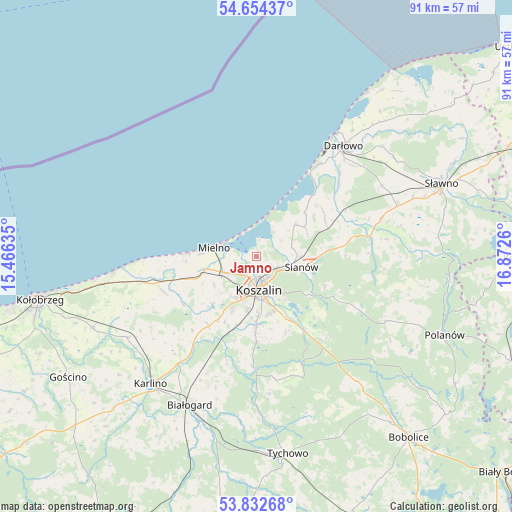
Jamno GPS coordinates[2]
54° 14' 44.052" North, 16° 10' 10.092" East
| Map corner | latitude | longitude |
|---|---|---|
| Upper-left | 54.65437°, | 15.46635° |
| Center: | 54.24557°, | 16.16947° |
| Lower-right: | 53.83268°, | 16.8726° |
| Map W x H: | 91.4×91.4 km | = 56.8×56.8mi |
| max Lat: | 54.83135° ⇑3.1% North |
| Jamno: | 54.24557° |
| min Lat: | ⇓96.9% South 49.21328° |
| min Long | Jamno | max Long |
| 14.20249° | 16.16947° | 24.03723° |
| W 8.4%⇐ | ⇒91.6% E |
Elevation
Elevation of Jamno is 8 m = 26 ft, and this is 183.4 m = 602 ft below average elevation for this country.
| Max E: |
974 m = 3196 ft | 98.4% |
| Avg. | 191.4 m = 628 ft | |
| Jamno | 8 m = 26 ft | |
Min E: |
-3 m = -10 ft | 1.6% |
See also: Poland elevation on elevation.city.
Geographical zone
Jamno is located in North temperate zone (between Tropic of Cancer and the Arctic Circle). Distance of this North polar circle is 1369.6 km =851 mi to North.| Distance of | km | miles | from Jamno |
|---|---|---|---|
| North Pole | 3975.5 | 2470.3 | to North |
| Arctic Circle | 1369.6 | 851 | to North |
| Tropic Cancer | 3425.6 | 2128.6 | to South |
| Equator | 6031.5 | 3747.8 | to South |


Nearby cities:
15 places around Jamno: (largest is in red/bold)
• Białogard
29.1 km =18.1 mi,  204°
204°
• Biesiekierz
15.1 km =9.4 mi,  214°
214°
• Będzino
12.3 km =7.6 mi,  251°
251°
• Darłowo
25 km =15.5 mi,  38°
38°
• Dygowo
31.9 km =19.8 mi, 246°
• Karlino
30.2 km =18.8 mi,  219°
219°
• Koszalin
5.7 km =3.5 mi,  178°
178°
• Malechowo
23.5 km =14.6 mi,  72°
72°
• Manowo
15.8 km =9.8 mi,  147°
147°
• Mielno
7.2 km =4.5 mi,  283°
283°
• Ostrowiec
32.7 km =20.3 mi,  84°
84°
• Sarbinowo
13.7 km =8.5 mi,  271°
271°
• Sianów
8.2 km =5.1 mi,  105°
105°
• Sławno
35.5 km =22.1 mi, 68°
• Ustronie Morskie
27.1 km =16.8 mi,  262°
262°
Sources, notices
• [Note1] Compared only with cities in Poland existing in our database
• [Src1] Map data: © OpenStreetMap contributors (CC-BY-SA)
• [Src2] Other city data from geonames.org with taken over terms of usage.
• [Src3] Geographical zone / Annual Mean Temperature by Robert A. Rohde @ Wikipedia
