Biesiekierz geodata
Biesiekierz (West Pomerania) is a populated place; located in Poland in Europe/Warsaw (GMT+2) time zone. With population of 998 people, there are 2502 cities with bigger population in this country. Compared to other cities in Poland, 95.6% of cities are located further ↓South; 92.3% of cities are located further →East and 96% of cities have higher elevation than Biesiekierz. Note1
Administrative division(s):
- Level 1: West Pomerania
- Level 2: Powiat koszaliński
- Level 3: Biesiekierz


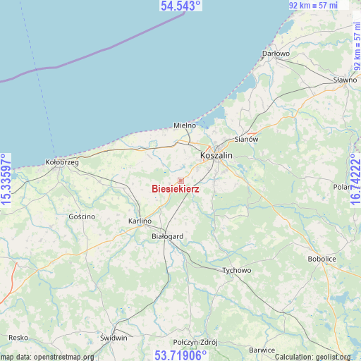
Biesiekierz GPS coordinates[2]
54° 7' 59.088" North, 16° 2' 20.724" East
| Map corner | latitude | longitude |
|---|---|---|
| Upper-left | 54.543°, | 15.33597° |
| Center: | 54.13308°, | 16.03909° |
| Lower-right: | 53.71906°, | 16.74222° |
| Map W x H: | 91.6×91.6 km | = 56.9×56.9mi |
| max Lat: | 54.83135° ⇑4.4% North |
| Biesiekierz: | 54.13308° |
| min Lat: | ⇓95.6% South 49.21328° |
| min Long | Biesiekierz | max Long |
| 14.20249° | 16.03909° | 24.03723° |
| W 7.7%⇐ | ⇒92.3% E |
Elevation
Elevation of Biesiekierz is 32 m = 105 ft, and this is 159.4 m = 523 ft below average elevation for this country.
| Max E: |
974 m = 3196 ft | 96% |
| Avg. | 191.4 m = 628 ft | |
| Biesiekierz | 32 m = 105 ft | |
Min E: |
-3 m = -10 ft | 4% |
See also: Poland elevation on elevation.city.
Geographical zone
Biesiekierz is located in North temperate zone (between Tropic of Cancer and the Arctic Circle). Distance of this North polar circle is 1382.1 km =858.8 mi to North.| Distance of | km | miles | from Biesiekierz |
|---|---|---|---|
| North Pole | 3988 | 2478 | to North |
| Arctic Circle | 1382.1 | 858.8 | to North |
| Tropic Cancer | 3413.1 | 2120.8 | to South |
| Equator | 6019 | 3740 | to South |


Nearby cities:
15 places around Biesiekierz: (largest is in red/bold)
• Białogard
14.4 km =8.9 mi,  193°
193°
• Będzino
9.1 km =5.7 mi,  339°
339°
• Dygowo
20.8 km =12.9 mi,  269°
269°
• Gościno
26.8 km =16.7 mi,  250°
250°
• Jamno
15.1 km =9.4 mi,  34°
34°
• Karlino
15.2 km =9.4 mi,  224°
224°
• Koszalin
11 km =6.8 mi,  51°
51°
• Kołobrzeg
30 km =18.6 mi,  279°
279°
• Manowo
17.1 km =10.6 mi,  92°
92°
• Mielno
14.3 km =8.9 mi,  6°
6°
• Rąbino
30.3 km =18.8 mi, 191°
• Sarbinowo
13.9 km =8.6 mi, 337°
• Sianów
19.4 km =12.1 mi,  57°
57°
• Tychowo
26.9 km =16.7 mi,  147°
147°
• Ustronie Morskie
20.6 km =12.8 mi,  296°
296°
Sources, notices
• [Note1] Compared only with cities in Poland existing in our database
• [Src1] Map data: © OpenStreetMap contributors (CC-BY-SA)
• [Src2] Other city data from geonames.org with taken over terms of usage.
• [Src3] Geographical zone / Annual Mean Temperature by Robert A. Rohde @ Wikipedia
