Gajków geodata
Gajków (Lower Silesia) is a populated place; located in Poland in Europe/Warsaw (GMT+2) time zone. With population of 538 people, there are 3440 cities with bigger population in this country. Compared to other cities in Poland, 53.7% of cities are located further ↑North; 82.3% of cities are located further →East and 69.3% of cities have higher elevation than Gajków. Note1


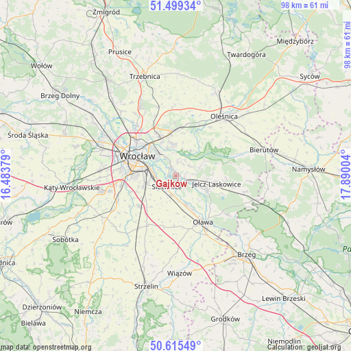
Gajków GPS coordinates[2]
51° 3' 34.272" North, 17° 11' 12.876" East
| Map corner | latitude | longitude |
|---|---|---|
| Upper-left | 51.49934°, | 16.48379° |
| Center: | 51.05952°, | 17.18691° |
| Lower-right: | 50.61549°, | 17.89004° |
| Map W x H: | 98.3×98.3 km | = 61.1×61.1mi |
| max Lat: | 54.83135° ⇑53.7% North |
| Gajków: | 51.05952° |
| min Lat: | ⇓46.3% South 49.21328° |
| min Long | Gajków | max Long |
| 14.20249° | 17.18691° | 24.03723° |
| W 17.7%⇐ | ⇒82.3% E |
Elevation
Elevation of Gajków is 122 m = 400 ft, and this is 69.4 m = 228 ft below average elevation for this country.
| Max E: |
974 m = 3196 ft | 69.3% |
| Avg. | 191.4 m = 628 ft | |
| Gajków | 122 m = 400 ft | |
Min E: |
-3 m = -10 ft | 30.7% |
See also: Poland elevation on elevation.city.
Geographical zone
Gajków is located in North temperate zone (between Tropic of Cancer and the Arctic Circle). Distance of this North polar circle is 1723.9 km =1071.2 mi to North.| Distance of | km | miles | from Gajków |
|---|---|---|---|
| North Pole | 4329.8 | 2690.4 | to North |
| Arctic Circle | 1723.9 | 1071.2 | to North |
| Tropic Cancer | 3071.4 | 1908.5 | to South |
| Equator | 5677.3 | 3527.7 | to South |


Nearby cities:
15 places around Gajków: (largest is in red/bold)
• Biskupin
7.4 km =4.6 mi,  308°
308°
• Czernica
4.3 km =2.7 mi,  110°
110°
• Dobrzykowice
3.8 km =2.4 mi,  5°
5°
• Kamieniec Wrocławski
1.4 km =0.9 mi,  345°
345°
• Księże Małe-Księże Wielkie
7 km =4.3 mi,  282°
282°
• Miłoszyce
8.9 km =5.5 mi,  96°
96°
• Radwanice
5.5 km =3.4 mi,  263°
263°
• Rakowiec-Opatowice
6.7 km =4.2 mi,  299°
299°
• Ratowice
6.6 km =4.1 mi,  116°
116°
• Siechnice
4 km =2.5 mi,  224°
224°
• Strachocin-Wojnów
5.6 km =3.5 mi,  333°
333°
• Swojczyce
7.6 km =4.7 mi, 325°
• Sępolno
8.2 km =5.1 mi, 313°
• Wilczyce
8.1 km =5 mi,  343°
343°
• Święta Katarzyna
6.3 km =3.9 mi,  233°
233°
Sources, notices
• [Note1] Compared only with cities in Poland existing in our database
• [Src1] Map data: © OpenStreetMap contributors (CC-BY-SA)
• [Src2] Other city data from geonames.org with taken over terms of usage.
• [Src3] Geographical zone / Annual Mean Temperature by Robert A. Rohde @ Wikipedia
