Dębnica Kaszubska geodata
Dębnica Kaszubska (Pomerania) is a seat of a third-order administrative division; located in Poland in Europe/Warsaw (GMT+2) time zone. With population of 3,220 people, there are 985 cities with bigger population in this country. Compared to other cities in Poland, 98.3% of cities are located further ↓South; 82.6% of cities are located further →East and 94.5% of cities have higher elevation than Dębnica Kaszubska. Note1


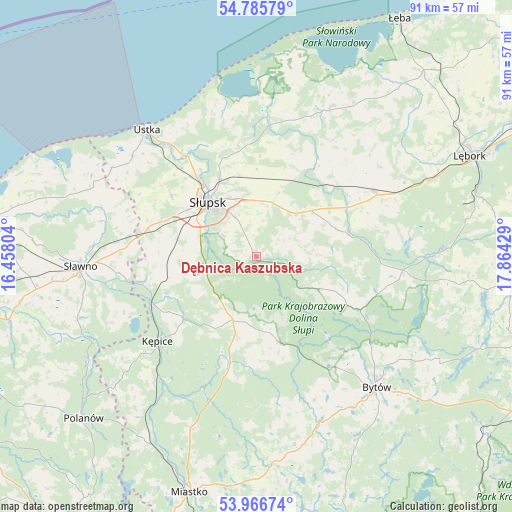
Dębnica Kaszubska GPS coordinates[2]
54° 22' 41.916" North, 17° 9' 40.176" East
| Map corner | latitude | longitude |
|---|---|---|
| Upper-left | 54.78579°, | 16.45804° |
| Center: | 54.37831°, | 17.16116° |
| Lower-right: | 53.96674°, | 17.86429° |
| Map W x H: | 91.1×91.1 km | = 56.6×56.6mi |
| max Lat: | 54.83135° ⇑1.7% North |
| Dębnica Kaszubska: | 54.37831° |
| min Lat: | ⇓98.3% South 49.21328° |
| min Long | Dębnica Kaszub | max Long |
| 14.20249° | 17.16116° | 24.03723° |
| W 17.4%⇐ | ⇒82.6% E |
Elevation
Elevation of Dębnica Kaszubska is 47 m = 154 ft, and this is 144.4 m = 474 ft below average elevation for this country.
| Max E: |
974 m = 3196 ft | 94.5% |
| Avg. | 191.4 m = 628 ft | |
| Dębnica Kaszubska | 47 m = 154 ft | |
Min E: |
-3 m = -10 ft | 5.5% |
See also: Poland elevation on elevation.city.
Geographical zone
Dębnica Kaszubska is located in North temperate zone (between Tropic of Cancer and the Arctic Circle). Distance of this North polar circle is 1354.9 km =841.9 mi to North.| Distance of | km | miles | from Dębnica Kaszubska |
|---|---|---|---|
| North Pole | 3960.8 | 2461.1 | to North |
| Arctic Circle | 1354.9 | 841.9 | to North |
| Tropic Cancer | 3440.4 | 2137.8 | to South |
| Equator | 6046.3 | 3757 | to South |


Nearby cities:
15 places around Dębnica Kaszubska: (largest is in red/bold)
• Barcino
17.1 km =10.6 mi,  228°
228°
• Bobrowniki
20 km =12.4 mi,  34°
34°
• Borzytuchom
23.9 km =14.9 mi,  145°
145°
• Czarna Dąbrówka
26.2 km =16.3 mi,  95°
95°
• Damnica
15.3 km =9.5 mi, 27°
• Główczyce
30.1 km =18.7 mi, 26°
• Kobylnica
12.6 km =7.8 mi,  302°
302°
• Kołczygłowy
16.2 km =10.1 mi,  163°
163°
• Kępice
23.3 km =14.5 mi, 229°
• Objazda
26.6 km =16.5 mi,  343°
343°
• Potęgowo
24 km =14.9 mi,  61°
61°
• Słupsk
12.8 km =8 mi,  318°
318°
• Trzebielino
20.4 km =12.7 mi,  193°
193°
• Ustka
29.6 km =18.4 mi, 319°
• Łupawa
17 km =10.6 mi,  74°
74°
Sources, notices
• [Note1] Compared only with cities in Poland existing in our database
• [Src1] Map data: © OpenStreetMap contributors (CC-BY-SA)
• [Src2] Other city data from geonames.org with taken over terms of usage.
• [Src3] Geographical zone / Annual Mean Temperature by Robert A. Rohde @ Wikipedia
