Czarna Dąbrówka geodata
Czarna Dąbrówka (Pomerania) is a seat of a third-order administrative division; located in Poland in Europe/Warsaw (GMT+2) time zone. With population of 1,112 people, there are 2292 cities with bigger population in this country. Compared to other cities in Poland, 98.1% of cities are located further ↓South; 79.3% of cities are located further →East and 68.6% of cities have higher elevation than Czarna Dąbrówka. Note1


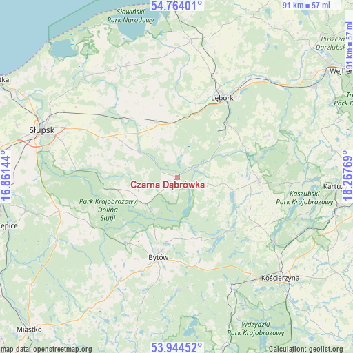
Czarna Dąbrówka GPS coordinates[2]
54° 21' 22.716" North, 17° 33' 52.416" East
| Map corner | latitude | longitude |
|---|---|---|
| Upper-left | 54.76401°, | 16.86144° |
| Center: | 54.35631°, | 17.56456° |
| Lower-right: | 53.94452°, | 18.26769° |
| Map W x H: | 91.1×91.1 km | = 56.6×56.6mi |
| max Lat: | 54.83135° ⇑1.9% North |
| Czarna Dąbrówka: | 54.35631° |
| min Lat: | ⇓98.1% South 49.21328° |
| min Long | Czarna Dąbrów | max Long |
| 14.20249° | 17.56456° | 24.03723° |
| W 20.7%⇐ | ⇒79.3% E |
Elevation
Elevation of Czarna Dąbrówka is 124 m = 407 ft, and this is 67.4 m = 221 ft below average elevation for this country.
| Max E: |
974 m = 3196 ft | 68.6% |
| Avg. | 191.4 m = 628 ft | |
| Czarna Dąbrówka | 124 m = 407 ft | |
Min E: |
-3 m = -10 ft | 31.4% |
See also: Poland elevation on elevation.city.
Geographical zone
Czarna Dąbrówka is located in North temperate zone (between Tropic of Cancer and the Arctic Circle). Distance of this North polar circle is 1357.3 km =843.4 mi to North.| Distance of | km | miles | from Czarna Dąbrówka |
|---|---|---|---|
| North Pole | 3963.2 | 2462.6 | to North |
| Arctic Circle | 1357.3 | 843.4 | to North |
| Tropic Cancer | 3437.9 | 2136.2 | to South |
| Equator | 6043.9 | 3755.5 | to South |


Nearby cities:
15 places around Czarna Dąbrówka: (largest is in red/bold)
• Bobrowniki
24 km =14.9 mi,  321°
321°
• Borzytuchom
21.5 km =13.4 mi,  216°
216°
• Bytów
21.2 km =13.2 mi,  192°
192°
• Cewice
14.1 km =8.8 mi,  51°
51°
• Damnica
24.8 km =15.4 mi,  310°
310°
• Kołczygłowy
25.2 km =15.7 mi,  238°
238°
• Linia
26.2 km =16.3 mi,  66°
66°
• Lębork
23.6 km =14.7 mi,  30°
30°
• Maszewo Lęborskie
16.9 km =10.5 mi,  41°
41°
• Nowa Wieś Lęborska
24.9 km =15.5 mi, 25°
• Parchowo
18 km =11.2 mi,  158°
158°
• Potęgowo
15 km =9.3 mi,  340°
340°
• Sierakowice
21.3 km =13.2 mi,  93°
93°
• Sulęczyno
19.3 km =12 mi,  135°
135°
• Łupawa
11.9 km =7.4 mi, 305°
Sources, notices
• [Note1] Compared only with cities in Poland existing in our database
• [Src1] Map data: © OpenStreetMap contributors (CC-BY-SA)
• [Src2] Other city data from geonames.org with taken over terms of usage.
• [Src3] Geographical zone / Annual Mean Temperature by Robert A. Rohde @ Wikipedia
