Chmielowice geodata
Chmielowice (Opole Voivodeship) is a populated place; located in Poland in Europe/Warsaw (GMT+2) time zone. With population of 1,500 people, there are 1837 cities with bigger population in this country. Compared to other cities in Poland, 63.9% of cities are located further ↑North; 76.5% of cities are located further →East and 54.9% of cities have higher elevation than Chmielowice. Note1
Administrative division(s):
- Level 1: Opole Voivodeship
- Level 2: Powiat opolski
- Level 3: Komprachcice


Chmielowice GPS coordinates[2]
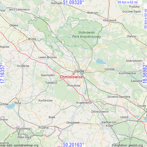
50° 38' 58.452" North, 17° 52' 0.084" East
| Map corner | latitude | longitude |
|---|---|---|
| Upper-left | 51.09328°, | 17.16357° |
| Center: | 50.64957°, | 17.86669° |
| Lower-right: | 50.20163°, | 18.56982° |
| Map W x H: | 99.1×99.1 km | = 61.6×61.6mi |
| max Lat: | 54.83135° ⇑63.9% North |
| Chmielowice: | 50.64957° |
| min Lat: | ⇓36.1% South 49.21328° |
| min Long | Chmielowice | max Long |
| 14.20249° | 17.86669° | 24.03723° |
| W 23.5%⇐ | ⇒76.5% E |
Elevation
Elevation of Chmielowice is 159 m = 522 ft, and this is 32.4 m = 106 ft below average elevation for this country.
| Max E: |
974 m = 3196 ft | 54.9% |
| Avg. | 191.4 m = 628 ft | |
| Chmielowice | 159 m = 522 ft | |
Min E: |
-3 m = -10 ft | 45.1% |
See also: Poland elevation on elevation.city.
Geographical zone
Chmielowice is located in North temperate zone (between Tropic of Cancer and the Arctic Circle). Distance of this North polar circle is 1769.5 km =1099.5 mi to North.| Distance of | km | miles | from Chmielowice |
|---|---|---|---|
| North Pole | 4375.4 | 2718.7 | to North |
| Arctic Circle | 1769.5 | 1099.5 | to North |
| Tropic Cancer | 3025.8 | 1880.1 | to South |
| Equator | 5631.7 | 3499.4 | to South |


Nearby cities:
15 places around Chmielowice: (largest is in red/bold)
• Borkowice
14.7 km =9.1 mi,  313°
313°
• Chrościna
3.9 km =2.4 mi,  297°
297°
• Chrząstowice
14.7 km =9.1 mi,  82°
82°
• Chróścice
15.1 km =9.4 mi,  345°
345°
• Czarnowąsy
9.1 km =5.7 mi,  14°
14°
• Dobrzeń Wielki
13.3 km =8.3 mi, 353°
• Dąbrowa
9.1 km =5.7 mi,  294°
294°
• Karczów
8.3 km =5.2 mi,  315°
315°
• Komprachcice
3.2 km =2 mi,  243°
243°
• Kosorowice
15.4 km =9.6 mi,  124°
124°
• Kąty Opolskie
12.6 km =7.8 mi,  142°
142°
• Opole
4.8 km =3 mi,  58°
58°
• Prószków
8.1 km =5 mi,  177°
177°
• Swierkle
13.5 km =8.4 mi,  19°
19°
• Węgry
14.9 km =9.3 mi,  45°
45°
Sources, notices
• [Note1] Compared only with cities in Poland existing in our database
• [Src1] Map data: © OpenStreetMap contributors (CC-BY-SA)
• [Src2] Other city data from geonames.org with taken over terms of usage.
• [Src3] Geographical zone / Annual Mean Temperature by Robert A. Rohde @ Wikipedia
