Borkowice geodata
Borkowice (Opole Voivodeship) is a populated place; located in Poland in Europe/Warsaw (GMT+2) time zone. With population of 588 people, there are 3319 cities with bigger population in this country. Compared to other cities in Poland, 61.7% of cities are located further ↑North; 78.1% of cities are located further →East and 55.6% of cities have higher elevation than Borkowice. Note1
Administrative division(s):
- Level 1: Opole Voivodeship
- Level 2: Powiat brzeski
- Level 3: Lewin Brzeski


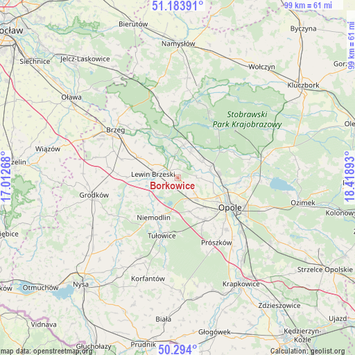
Borkowice GPS coordinates[2]
50° 44' 27.852" North, 17° 42' 56.88" East
| Map corner | latitude | longitude |
|---|---|---|
| Upper-left | 51.18391°, | 17.01268° |
| Center: | 50.74107°, | 17.7158° |
| Lower-right: | 50.294°, | 18.41893° |
| Map W x H: | 98.9×98.9 km | = 61.5×61.5mi |
| max Lat: | 54.83135° ⇑61.7% North |
| Borkowice: | 50.74107° |
| min Lat: | ⇓38.3% South 49.21328° |
| min Long | Borkowice | max Long |
| 14.20249° | 17.7158° | 24.03723° |
| W 21.9%⇐ | ⇒78.1% E |
Elevation
Elevation of Borkowice is 157 m = 515 ft, and this is 34.4 m = 113 ft below average elevation for this country.
| Max E: |
974 m = 3196 ft | 55.6% |
| Avg. | 191.4 m = 628 ft | |
| Borkowice | 157 m = 515 ft | |
Min E: |
-3 m = -10 ft | 44.4% |
See also: Poland elevation on elevation.city.
Geographical zone
Borkowice is located in North temperate zone (between Tropic of Cancer and the Arctic Circle). Distance of this North polar circle is 1759.3 km =1093.2 mi to North.| Distance of | km | miles | from Borkowice |
|---|---|---|---|
| North Pole | 4365.2 | 2712.4 | to North |
| Arctic Circle | 1759.3 | 1093.2 | to North |
| Tropic Cancer | 3036 | 1886.5 | to South |
| Equator | 5641.9 | 3505.7 | to South |


Nearby cities:
15 places around Borkowice: (largest is in red/bold)
• Chmielowice
14.7 km =9.1 mi,  133°
133°
• Chrościna
11 km =6.8 mi,  139°
139°
• Chróścice
8.1 km =5 mi,  56°
56°
• Czarnowąsy
12.9 km =8 mi,  96°
96°
• Dobrzeń Wielki
9.7 km =6 mi,  71°
71°
• Dąbrowa
6.8 km =4.2 mi,  159°
159°
• Karczów
6.4 km =4 mi, 130°
• Komprachcice
14 km =8.7 mi,  146°
146°
• Kup
13.9 km =8.6 mi, 58°
• Lewin Brzeski
7 km =4.3 mi,  276°
276°
• Michałow
14.6 km =9.1 mi,  271°
271°
• Niemodlin
12.9 km =8 mi,  211°
211°
• Popielów
9.7 km =6 mi,  11°
11°
• Skorogoszcz
3.1 km =1.9 mi,  310°
310°
• Łosiów
11.9 km =7.4 mi,  297°
297°
Sources, notices
• [Note1] Compared only with cities in Poland existing in our database
• [Src1] Map data: © OpenStreetMap contributors (CC-BY-SA)
• [Src2] Other city data from geonames.org with taken over terms of usage.
• [Src3] Geographical zone / Annual Mean Temperature by Robert A. Rohde @ Wikipedia
