Dobrzeń Wielki geodata
Dobrzeń Wielki (Opole Voivodeship) is a populated place; located in Poland in Europe/Warsaw (GMT+2) time zone. With population of 4,500 people, there are 730 cities with bigger population in this country. Compared to other cities in Poland, 61% of cities are located further ↑North; 76.7% of cities are located further →East and 59.5% of cities have higher elevation than Dobrzeń Wielki. Note1
Administrative division(s):
- Level 1: Opole Voivodeship
- Level 2: Powiat opolski
- Level 3: Dobrzeń Wielki


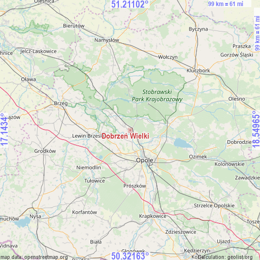
Dobrzeń Wielki GPS coordinates[2]
50° 46' 6.384" North, 17° 50' 47.472" East
| Map corner | latitude | longitude |
|---|---|---|
| Upper-left | 51.21102°, | 17.1434° |
| Center: | 50.76844°, | 17.84652° |
| Lower-right: | 50.32163°, | 18.54965° |
| Map W x H: | 98.9×98.9 km | = 61.5×61.5mi |
| max Lat: | 54.83135° ⇑61% North |
| Dobrzeń Wielki: | 50.76844° |
| min Lat: | ⇓39% South 49.21328° |
| min Long | Dobrzeń Wielki | max Long |
| 14.20249° | 17.84652° | 24.03723° |
| W 23.3%⇐ | ⇒76.7% E |
Elevation
Elevation of Dobrzeń Wielki is 148 m = 486 ft, and this is 43.4 m = 142 ft below average elevation for this country.
| Max E: |
974 m = 3196 ft | 59.5% |
| Avg. | 191.4 m = 628 ft | |
| Dobrzeń Wielki | 148 m = 486 ft | |
Min E: |
-3 m = -10 ft | 40.5% |
See also: Poland elevation on elevation.city.
Geographical zone
Dobrzeń Wielki is located in North temperate zone (between Tropic of Cancer and the Arctic Circle). Distance of this North polar circle is 1756.3 km =1091.3 mi to North.| Distance of | km | miles | from Dobrzeń Wielki |
|---|---|---|---|
| North Pole | 4362.1 | 2710.5 | to North |
| Arctic Circle | 1756.3 | 1091.3 | to North |
| Tropic Cancer | 3039 | 1888.3 | to South |
| Equator | 5644.9 | 3507.6 | to South |


Nearby cities:
15 places around Dobrzeń Wielki: (largest is in red/bold)
• Borkowice
9.7 km =6 mi,  251°
251°
• Chmielowice
13.3 km =8.3 mi,  173°
173°
• Chrościna
11.6 km =7.2 mi,  190°
190°
• Chróścice
2.8 km =1.7 mi,  299°
299°
• Czarnowąsy
5.7 km =3.5 mi,  140°
140°
• Dąbrowa
11.6 km =7.2 mi,  215°
215°
• Karczów
8.5 km =5.3 mi,  211°
211°
• Kup
5 km =3.1 mi,  31°
31°
• Murów
12.6 km =7.8 mi, 33°
• Opole
12.1 km =7.5 mi,  152°
152°
• Popielów
9.7 km =6 mi,  311°
311°
• Skorogoszcz
11.6 km =7.2 mi,  264°
264°
• Swierkle
5.9 km =3.7 mi,  94°
94°
• Węgry
12.3 km =7.6 mi,  103°
103°
• Łubniany
11 km =6.8 mi,  79°
79°
Sources, notices
• [Note1] Compared only with cities in Poland existing in our database
• [Src1] Map data: © OpenStreetMap contributors (CC-BY-SA)
• [Src2] Other city data from geonames.org with taken over terms of usage.
• [Src3] Geographical zone / Annual Mean Temperature by Robert A. Rohde @ Wikipedia
