Chojna geodata
Chojna (West Pomerania) is a seat of a third-order administrative division; located in Poland in Europe/Warsaw (GMT+2) time zone. With population of 7,398 people, there are 522 cities with bigger population in this country. Compared to other cities in Poland, 83.1% of cities are located further ↓South; 99.8% of cities are located further →East and 97.2% of cities have higher elevation than Chojna. Note1


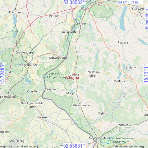
Chojna GPS coordinates[2]
52° 57' 50.004" North, 14° 25' 40.692" East
| Map corner | latitude | longitude |
|---|---|---|
| Upper-left | 53.38532°, | 13.72485° |
| Center: | 52.96389°, | 14.42797° |
| Lower-right: | 52.53831°, | 15.1311° |
| Map W x H: | 94.2×94.2 km | = 58.5×58.5mi |
| max Lat: | 54.83135° ⇑16.9% North |
| Chojna: | 52.96389° |
| min Lat: | ⇓83.1% South 49.21328° |
| min Long | Chojna | max Long |
| 14.20249° | 14.42797° | 24.03723° |
| W 0.2%⇐ | ⇒99.8% E |
Elevation
Elevation of Chojna is 20 m = 66 ft, and this is 171.4 m = 562 ft below average elevation for this country.
| Max E: |
974 m = 3196 ft | 97.2% |
| Avg. | 191.4 m = 628 ft | |
| Chojna | 20 m = 66 ft | |
Min E: |
-3 m = -10 ft | 2.8% |
See also: Poland elevation on elevation.city.
Geographical zone
Chojna is located in North temperate zone (between Tropic of Cancer and the Arctic Circle). Distance of this North polar circle is 1512.1 km =939.6 mi to North.| Distance of | km | miles | from Chojna |
|---|---|---|---|
| North Pole | 4118 | 2558.8 | to North |
| Arctic Circle | 1512.1 | 939.6 | to North |
| Tropic Cancer | 3283.1 | 2040 | to South |
| Equator | 5889 | 3659.3 | to South |


Nearby cities:
15 places around Chojna: (largest is in red/bold)
• Banie
21.8 km =13.5 mi,  45°
45°
• Bielin
15.1 km =9.4 mi,  173°
173°
• Boleszkowice
28.2 km =17.5 mi,  160°
160°
• Cedynia
17.8 km =11.1 mi,  238°
238°
• Dębno
30.9 km =19.2 mi,  144°
144°
• Kozielice
30.8 km =19.1 mi,  58°
58°
• Lubanowo
22.2 km =13.8 mi,  33°
33°
• Mieszkowice
20.1 km =12.5 mi, 167°
• Moryń
12 km =7.5 mi,  191°
191°
• Myślibórz
29.8 km =18.5 mi,  98°
98°
• Oborzany
29.7 km =18.5 mi,  147°
147°
• Troszyn
23.2 km =14.4 mi, 157°
• Trzcińsko Zdrój
12 km =7.5 mi,  89°
89°
• Widuchowa
18.3 km =11.4 mi,  352°
352°
• Witnica
10.8 km =6.7 mi, 163°
Sources, notices
• [Note1] Compared only with cities in Poland existing in our database
• [Src1] Map data: © OpenStreetMap contributors (CC-BY-SA)
• [Src2] Other city data from geonames.org with taken over terms of usage.
• [Src3] Geographical zone / Annual Mean Temperature by Robert A. Rohde @ Wikipedia
