Kozielice geodata
Kozielice (West Pomerania) is a seat of a third-order administrative division; located in Poland in Europe/Warsaw (GMT+2) time zone. In our database, there are 3649 cities with bigger population. Compared to other cities in Poland, 85.1% of cities are located further ↓South; 98.8% of cities are located further →East and 92% of cities have higher elevation than Kozielice. Note1


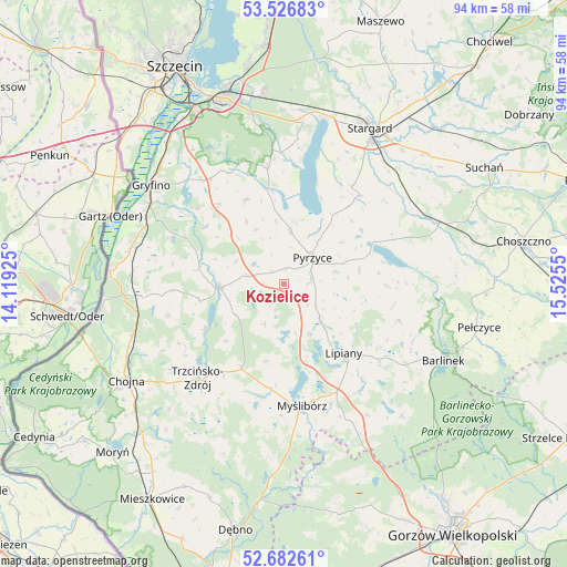
Kozielice GPS coordinates[2]
53° 6' 24.444" North, 14° 49' 20.532" East
| Map corner | latitude | longitude |
|---|---|---|
| Upper-left | 53.52683°, | 14.11925° |
| Center: | 53.10679°, | 14.82237° |
| Lower-right: | 52.68261°, | 15.5255° |
| Map W x H: | 93.9×93.9 km | = 58.3×58.3mi |
| max Lat: | 54.83135° ⇑14.9% North |
| Kozielice: | 53.10679° |
| min Lat: | ⇓85.1% South 49.21328° |
| min Long | Kozielice | max Long |
| 14.20249° | 14.82237° | 24.03723° |
| W 1.2%⇐ | ⇒98.8% E |
Elevation
Elevation of Kozielice is 65 m = 213 ft, and this is 126.4 m = 415 ft below average elevation for this country.
| Max E: |
974 m = 3196 ft | 92% |
| Avg. | 191.4 m = 628 ft | |
| Kozielice | 65 m = 213 ft | |
Min E: |
-3 m = -10 ft | 8% |
See also: Poland elevation on elevation.city.
Geographical zone
Kozielice is located in North temperate zone (between Tropic of Cancer and the Arctic Circle). Distance of this North polar circle is 1496.3 km =929.8 mi to North.| Distance of | km | miles | from Kozielice |
|---|---|---|---|
| North Pole | 4102.1 | 2548.9 | to North |
| Arctic Circle | 1496.3 | 929.8 | to North |
| Tropic Cancer | 3299 | 2049.9 | to South |
| Equator | 5904.9 | 3669.1 | to South |


Nearby cities:
15 places around Kozielice: (largest is in red/bold)
• Banie
10.7 km =6.6 mi,  266°
266°
• Bielice
12.2 km =7.6 mi,  328°
328°
• Dolice
27 km =16.8 mi,  69°
69°
• Gryfino
27.5 km =17.1 mi,  306°
306°
• Kobylanka
26.7 km =16.6 mi,  7°
7°
• Lipiany
15.1 km =9.4 mi,  139°
139°
• Lubanowo
14.2 km =8.8 mi,  280°
280°
• Mostkowo
20.2 km =12.6 mi,  128°
128°
• Myślibórz
20.6 km =12.8 mi,  171°
171°
• Nowogródek Pomorski
25.8 km =16 mi,  147°
147°
• Przelewice
16.9 km =10.5 mi,  90°
90°
• Pyrzyce
6.4 km =4 mi,  46°
46°
• Stare Czarnowo
19.3 km =12 mi,  351°
351°
• Trzcińsko Zdrój
21.4 km =13.3 mi,  222°
222°
• Warnice
19.9 km =12.4 mi,  34°
34°
Sources, notices
• [Note1] Compared only with cities in Poland existing in our database
• [Src1] Map data: © OpenStreetMap contributors (CC-BY-SA)
• [Src2] Other city data from geonames.org with taken over terms of usage.
• [Src3] Geographical zone / Annual Mean Temperature by Robert A. Rohde @ Wikipedia
