Węgorzewo geodata
Węgorzewo (Warmia-Masuria) is a seat of a third-order administrative division; located in Poland in Europe/Warsaw (GMT+2) time zone. With population of 11,864 people, there are 399 cities with bigger population in this country. Compared to other cities in Poland, 96.6% of cities are located further ↓South; 81.5% of cities are located further ←West and 70.4% of cities have higher elevation than Węgorzewo. Note1


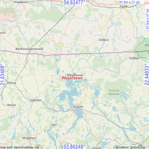
Węgorzewo GPS coordinates[2]
54° 12' 56.412" North, 21° 44' 13.92" East
| Map corner | latitude | longitude |
|---|---|---|
| Upper-left | 54.62477°, | 21.03408° |
| Center: | 54.21567°, | 21.7372° |
| Lower-right: | 53.80248°, | 22.44033° |
| Map W x H: | 91.4×91.4 km | = 56.8×56.8mi |
| max Lat: | 54.83135° ⇑3.4% North |
| Węgorzewo: | 54.21567° |
| min Lat: | ⇓96.6% South 49.21328° |
| min Long | Węgorzewo | max Long |
| 14.20249° | 21.7372° | 24.03723° |
| W 81.5%⇐ | ⇒18.5% E |
Elevation
Elevation of Węgorzewo is 120 m = 394 ft, and this is 71.4 m = 234 ft below average elevation for this country.
| Max E: |
974 m = 3196 ft | 70.4% |
| Avg. | 191.4 m = 628 ft | |
| Węgorzewo | 120 m = 394 ft | |
Min E: |
-3 m = -10 ft | 29.6% |
See also: Poland elevation on elevation.city.
Geographical zone
Węgorzewo is located in North temperate zone (between Tropic of Cancer and the Arctic Circle). Distance of this North polar circle is 1373 km =853.1 mi to North.| Distance of | km | miles | from Węgorzewo |
|---|---|---|---|
| North Pole | 3978.8 | 2472.3 | to North |
| Arctic Circle | 1373 | 853.1 | to North |
| Tropic Cancer | 3422.3 | 2126.5 | to South |
| Equator | 6028.2 | 3745.7 | to South |


Nearby cities:
15 places around Węgorzewo: (largest is in red/bold)
• Banie Mazurskie
19.7 km =12.2 mi,  79°
79°
• Barciany
25 km =15.5 mi,  271°
271°
• Gierłoż
21.7 km =13.5 mi,  226°
226°
• Giżycko
19.8 km =12.3 mi,  174°
174°
• Gołdap
38.1 km =23.7 mi,  74°
74°
• Grabowo
32.7 km =20.3 mi,  88°
88°
• Korsze
39.2 km =24.4 mi,  262°
262°
• Kruklanki
18.6 km =11.6 mi,  139°
139°
• Kętrzyn
28.2 km =17.5 mi,  236°
236°
• Miłki
31.8 km =19.8 mi,  162°
162°
• Pozezdrze
11.5 km =7.1 mi, 135°
• Reszel
42.7 km =26.5 mi, 244°
• Ryn
33.3 km =20.7 mi,  201°
201°
• Srokowo
13.9 km =8.6 mi, 269°
• Wydminy
32.3 km =20.1 mi, 143°
Sources, notices
• [Note1] Compared only with cities in Poland existing in our database
• [Src1] Map data: © OpenStreetMap contributors (CC-BY-SA)
• [Src2] Other city data from geonames.org with taken over terms of usage.
• [Src3] Geographical zone / Annual Mean Temperature by Robert A. Rohde @ Wikipedia
