Ludmiłówka geodata
Ludmiłówka (Lublin) is a populated place; located in Poland in Europe/Warsaw (GMT+2) time zone. With population of 530 people, there are 3452 cities with bigger population in this country. Compared to other cities in Poland, 56.8% of cities are located further ↑North; 85.3% of cities are located further ←West and 76.5% of cities have lower elevation than Ludmiłówka. Note1


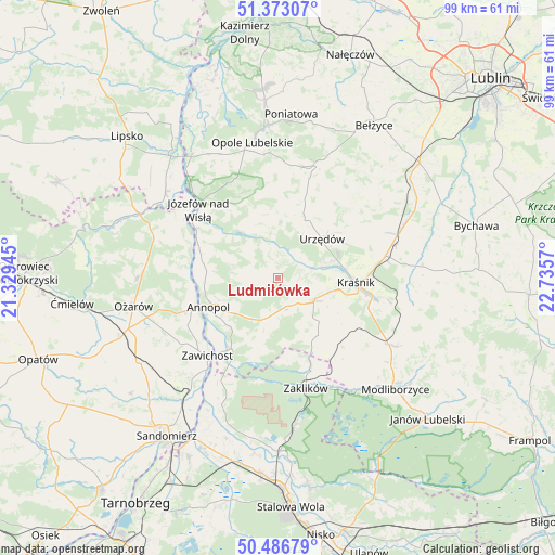
Ludmiłówka GPS coordinates[2]
50° 55' 55.344" North, 22° 1' 57.252" East
| Map corner | latitude | longitude |
|---|---|---|
| Upper-left | 51.37307°, | 21.32945° |
| Center: | 50.93204°, | 22.03257° |
| Lower-right: | 50.48679°, | 22.7357° |
| Map W x H: | 98.5×98.5 km | = 61.2×61.2mi |
| max Lat: | 54.83135° ⇑56.8% North |
| Ludmiłówka: | 50.93204° |
| min Lat: | ⇓43.2% South 49.21328° |
| min Long | Ludmiłówka | max Long |
| 14.20249° | 22.03257° | 24.03723° |
| W 85.3%⇐ | ⇒14.7% E |
Elevation
Elevation of Ludmiłówka is 252 m = 827 ft, and this is 60.6 m = 199 ft above average elevation for this country.
| Max E: |
974 m = 3196 ft | 23.5% |
| Ludmiłówka | 252 m 827 ft | |
| Avg. | 191.4 m = 628 ft | |
Min E: |
-3 m = -10 ft | 76.5% |
See also: Poland elevation on elevation.city.
Geographical zone
Ludmiłówka is located in North temperate zone (between Tropic of Cancer and the Arctic Circle). Distance of this North polar circle is 1738.1 km =1080 mi to North.| Distance of | km | miles | from Ludmiłówka |
|---|---|---|---|
| North Pole | 4343.9 | 2699.2 | to North |
| Arctic Circle | 1738.1 | 1080 | to North |
| Tropic Cancer | 3057.2 | 1899.7 | to South |
| Equator | 5663.1 | 3518.9 | to South |


Nearby cities:
15 places around Ludmiłówka: (largest is in red/bold)
• Annopol
13.4 km =8.3 mi,  247°
247°
• Dzierzkowice
3.9 km =2.4 mi,  37°
37°
• Gościeradów
7.3 km =4.5 mi,  195°
195°
• Józefów nad Wisłą
18.7 km =11.6 mi,  310°
310°
• Kraśnik
13.7 km =8.5 mi,  93°
93°
• Księżomierz
4 km =2.5 mi,  229°
229°
• Potok Wielki
20.3 km =12.6 mi,  140°
140°
• Rzeczyca Ziemiańska
14.5 km =9 mi,  132°
132°
• Trzydnik Duży
11.6 km =7.2 mi, 142°
• Urzędów
10.3 km =6.4 mi,  48°
48°
• Wierzbica
11.6 km =7.2 mi,  27°
27°
• Zaklików
20 km =12.4 mi,  165°
165°
• Zawichost
18.7 km =11.6 mi,  222°
222°
• Zdziechowice Drugie
17.3 km =10.7 mi,  161°
161°
• Zdziechowice Pierwsze
16.3 km =10.1 mi, 161°
Sources, notices
• [Note1] Compared only with cities in Poland existing in our database
• [Src1] Map data: © OpenStreetMap contributors (CC-BY-SA)
• [Src2] Other city data from geonames.org with taken over terms of usage.
• [Src3] Geographical zone / Annual Mean Temperature by Robert A. Rohde @ Wikipedia
