Ostrówek geodata
Ostrówek (Lublin) is a seat of a third-order administrative division; located in Poland in Europe/Warsaw (GMT+2) time zone. With population of 276 people, there are 3630 cities with bigger population in this country. Compared to other cities in Poland, 57.4% of cities are located further ↓South; 92.9% of cities are located further ←West and 61.5% of cities have higher elevation than Ostrówek. Note1


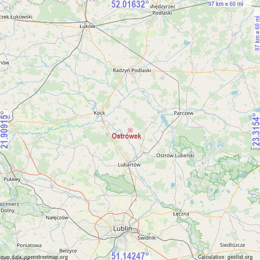
Ostrówek GPS coordinates[2]
51° 34' 53.4" North, 22° 36' 44.172" East
| Map corner | latitude | longitude |
|---|---|---|
| Upper-left | 52.01632°, | 21.90915° |
| Center: | 51.5815°, | 22.61227° |
| Lower-right: | 51.14247°, | 23.3154° |
| Map W x H: | 97.2×97.2 km | = 60.4×60.4mi |
| max Lat: | 54.83135° ⇑42.6% North |
| Ostrówek: | 51.5815° |
| min Lat: | ⇓57.4% South 49.21328° |
| min Long | Ostrówek | max Long |
| 14.20249° | 22.61227° | 24.03723° |
| W 92.9%⇐ | ⇒7.1% E |
Elevation
Elevation of Ostrówek is 143 m = 469 ft, and this is 48.4 m = 159 ft below average elevation for this country.
| Max E: |
974 m = 3196 ft | 61.5% |
| Avg. | 191.4 m = 628 ft | |
| Ostrówek | 143 m = 469 ft | |
Min E: |
-3 m = -10 ft | 38.5% |
See also: Poland elevation on elevation.city.
Geographical zone
Ostrówek is located in North temperate zone (between Tropic of Cancer and the Arctic Circle). Distance of this North polar circle is 1665.8 km =1035.1 mi to North.| Distance of | km | miles | from Ostrówek |
|---|---|---|---|
| North Pole | 4271.7 | 2654.3 | to North |
| Arctic Circle | 1665.8 | 1035.1 | to North |
| Tropic Cancer | 3129.4 | 1944.5 | to South |
| Equator | 5735.3 | 3563.7 | to South |


Nearby cities:
15 places around Ostrówek: (largest is in red/bold)
• Borki
16.8 km =10.4 mi,  338°
338°
• Brzeźnica Bychawska
11.3 km =7 mi,  121°
121°
• Czemierniki
10.3 km =6.4 mi,  10°
10°
• Firlej
7.6 km =4.7 mi,  250°
250°
• Kamionka
16 km =9.9 mi,  220°
220°
• Kock
13.3 km =8.3 mi,  299°
299°
• Kozłówka
16.7 km =10.4 mi,  208°
208°
• Lubartów
13.5 km =8.4 mi,  180°
180°
• Niedźwiada
6.9 km =4.3 mi,  127°
127°
• Ostrów Lubelski
19.3 km =12 mi, 120°
• Parczew
20.9 km =13 mi,  71°
71°
• Pałecznica
11.7 km =7.3 mi,  158°
158°
• Serniki
16.4 km =10.2 mi,  168°
168°
• Siemień
12.2 km =7.6 mi,  64°
64°
• Wola Sernicka
15.5 km =9.6 mi, 161°
Sources, notices
• [Note1] Compared only with cities in Poland existing in our database
• [Src1] Map data: © OpenStreetMap contributors (CC-BY-SA)
• [Src2] Other city data from geonames.org with taken over terms of usage.
• [Src3] Geographical zone / Annual Mean Temperature by Robert A. Rohde @ Wikipedia
