Kozłówka geodata
Kozłówka (Lublin) is a populated place; located in Poland in Europe/Warsaw (GMT+2) time zone. With population of 820 people, there are 2819 cities with bigger population in this country. Compared to other cities in Poland, 55.5% of cities are located further ↓South; 91.5% of cities are located further ←West and 56% of cities have higher elevation than Kozłówka. Note1


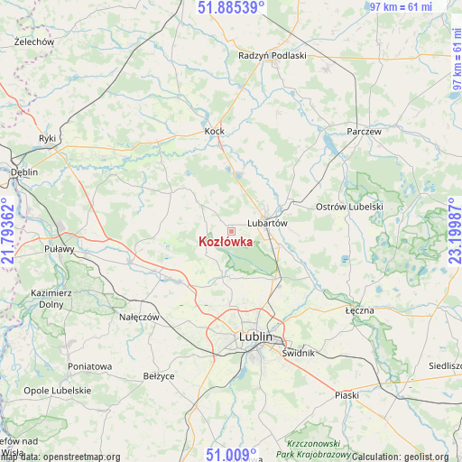
Kozłówka GPS coordinates[2]
51° 26' 57.48" North, 22° 29' 48.264" East
| Map corner | latitude | longitude |
|---|---|---|
| Upper-left | 51.88539°, | 21.79362° |
| Center: | 51.4493°, | 22.49674° |
| Lower-right: | 51.009°, | 23.19987° |
| Map W x H: | 97.4×97.4 km | = 60.5×60.5mi |
| max Lat: | 54.83135° ⇑44.5% North |
| Kozłówka: | 51.4493° |
| min Lat: | ⇓55.5% South 49.21328° |
| min Long | Kozłówka | max Long |
| 14.20249° | 22.49674° | 24.03723° |
| W 91.5%⇐ | ⇒8.5% E |
Elevation
Elevation of Kozłówka is 156 m = 512 ft, and this is 35.4 m = 116 ft below average elevation for this country.
| Max E: |
974 m = 3196 ft | 56% |
| Avg. | 191.4 m = 628 ft | |
| Kozłówka | 156 m = 512 ft | |
Min E: |
-3 m = -10 ft | 44% |
See also: Poland elevation on elevation.city.
Geographical zone
Kozłówka is located in North temperate zone (between Tropic of Cancer and the Arctic Circle). Distance of this North polar circle is 1680.5 km =1044.2 mi to North.| Distance of | km | miles | from Kozłówka |
|---|---|---|---|
| North Pole | 4286.4 | 2663.4 | to North |
| Arctic Circle | 1680.5 | 1044.2 | to North |
| Tropic Cancer | 3114.7 | 1935.4 | to South |
| Equator | 5720.6 | 3554.6 | to South |


Nearby cities:
15 places around Kozłówka: (largest is in red/bold)
• Abramów
12.6 km =7.8 mi,  273°
273°
• Firlej
12.2 km =7.6 mi,  3°
3°
• Garbów
15.6 km =9.7 mi,  227°
227°
• Jastków
16.7 km =10.4 mi,  194°
194°
• Kamionka
3.4 km =2.1 mi,  316°
316°
• Lubartów
7.9 km =4.9 mi,  81°
81°
• Markuszów
18.5 km =11.5 mi,  243°
243°
• Michów
15.2 km =9.4 mi,  303°
303°
• Niedźwiada
17.1 km =10.6 mi,  51°
51°
• Niemce
13.9 km =8.6 mi,  134°
134°
• Ostrówek
16.7 km =10.4 mi,  28°
28°
• Pałecznica
12.8 km =8 mi,  72°
72°
• Przybysławice
17.4 km =10.8 mi, 239°
• Serniki
11.3 km =7 mi,  96°
96°
• Wola Sernicka
12.9 km =8 mi,  89°
89°
Sources, notices
• [Note1] Compared only with cities in Poland existing in our database
• [Src1] Map data: © OpenStreetMap contributors (CC-BY-SA)
• [Src2] Other city data from geonames.org with taken over terms of usage.
• [Src3] Geographical zone / Annual Mean Temperature by Robert A. Rohde @ Wikipedia
