Mońki geodata
Mońki (Podlasie) is a seat of a third-order administrative division; located in Poland in Europe/Warsaw (GMT+2) time zone. With population of 10,577 people, there are 429 cities with bigger population in this country. Compared to other cities in Poland, 88.5% of cities are located further ↓South; 94.6% of cities are located further ←West and 50.2% of cities have lower elevation than Mońki. Note1


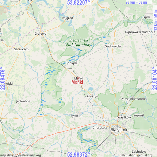
Mońki GPS coordinates[2]
53° 24' 17.856" North, 22° 47' 52.476" East
| Map corner | latitude | longitude |
|---|---|---|
| Upper-left | 53.82207°, | 22.09479° |
| Center: | 53.40496°, | 22.79791° |
| Lower-right: | 52.98372°, | 23.50104° |
| Map W x H: | 93.2×93.2 km | = 57.9×57.9mi |
| max Lat: | 54.83135° ⇑11.5% North |
| Mońki: | 53.40496° |
| min Lat: | ⇓88.5% South 49.21328° |
| min Long | Mońki | max Long |
| 14.20249° | 22.79791° | 24.03723° |
| W 94.6%⇐ | ⇒5.4% E |
Elevation
Elevation of Mońki is 172 m = 564 ft, and this is 19.4 m = 64 ft below average elevation for this country.
| Max E: |
974 m = 3196 ft | 49.8% |
| Avg. | 191.4 m = 628 ft | |
| Mońki | 172 m = 564 ft | |
Min E: |
-3 m = -10 ft | 50.2% |
See also: Poland elevation on elevation.city.
Geographical zone
Mońki is located in North temperate zone (between Tropic of Cancer and the Arctic Circle). Distance of this North polar circle is 1463.1 km =909.1 mi to North.| Distance of | km | miles | from Mońki |
|---|---|---|---|
| North Pole | 4069 | 2528.4 | to North |
| Arctic Circle | 1463.1 | 909.1 | to North |
| Tropic Cancer | 3332.2 | 2070.5 | to South |
| Equator | 5938.1 | 3689.8 | to South |


Nearby cities:
15 places around Mońki: (largest is in red/bold)
• Choroszcz
31.7 km =19.7 mi,  156°
156°
• Czarna Białostocka
34 km =21.1 mi,  109°
109°
• Dobrzyniewo Duże
26.8 km =16.7 mi,  148°
148°
• Goniadz
10.3 km =6.4 mi,  336°
336°
• Janów
29.5 km =18.3 mi,  76°
76°
• Jasionówka
15.9 km =9.9 mi,  93°
93°
• Jaświły
13 km =8.1 mi,  50°
50°
• Knyszyn
12.9 km =8 mi,  141°
141°
• Korycin
19.9 km =12.4 mi, 77°
• Radziłów
25.7 km =16 mi,  271°
271°
• Suchowola
28 km =17.4 mi, 46°
• Trzcianne
10 km =6.2 mi,  229°
229°
• Tykocin
22.2 km =13.8 mi,  184°
184°
• Wąsosz
34.3 km =21.3 mi,  292°
292°
• Złotoria
26.8 km =16.7 mi, 160°
Sources, notices
• [Note1] Compared only with cities in Poland existing in our database
• [Src1] Map data: © OpenStreetMap contributors (CC-BY-SA)
• [Src2] Other city data from geonames.org with taken over terms of usage.
• [Src3] Geographical zone / Annual Mean Temperature by Robert A. Rohde @ Wikipedia
