Miedniewice geodata
Miedniewice (Łódź Voivodeship) is a section of populated place; located in Poland in Europe/Warsaw (GMT+2) time zone. With population of 790 people, there are 2877 cities with bigger population in this country. Compared to other cities in Poland, 64.8% of cities are located further ↓South; 61.1% of cities are located further ←West and 67.1% of cities have higher elevation than Miedniewice. Note1
Administrative division(s):
- Level 1: Łódź Voivodeship
- Level 2: Powiat skierniewicki
- Level 3: Skierniewice


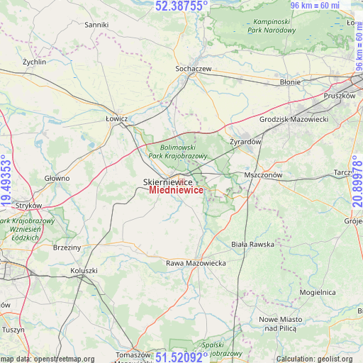
Miedniewice GPS coordinates[2]
51° 57' 22.788" North, 20° 11' 47.94" East
| Map corner | latitude | longitude |
|---|---|---|
| Upper-left | 52.38755°, | 19.49353° |
| Center: | 51.95633°, | 20.19665° |
| Lower-right: | 51.52092°, | 20.89978° |
| Map W x H: | 96.4×96.4 km | = 59.9×59.9mi |
| max Lat: | 54.83135° ⇑35.2% North |
| Miedniewice: | 51.95633° |
| min Lat: | ⇓64.8% South 49.21328° |
| min Long | Miedniewice | max Long |
| 14.20249° | 20.19665° | 24.03723° |
| W 61.1%⇐ | ⇒38.9% E |
Elevation
Elevation of Miedniewice is 128 m = 420 ft, and this is 63.4 m = 208 ft below average elevation for this country.
| Max E: |
974 m = 3196 ft | 67.1% |
| Avg. | 191.4 m = 628 ft | |
| Miedniewice | 128 m = 420 ft | |
Min E: |
-3 m = -10 ft | 32.9% |
See also: Poland elevation on elevation.city.
Geographical zone
Miedniewice is located in North temperate zone (between Tropic of Cancer and the Arctic Circle). Distance of this North polar circle is 1624.2 km =1009.2 mi to North.| Distance of | km | miles | from Miedniewice |
|---|---|---|---|
| North Pole | 4230.1 | 2628.5 | to North |
| Arctic Circle | 1624.2 | 1009.2 | to North |
| Tropic Cancer | 3171.1 | 1970.4 | to South |
| Equator | 5777 | 3589.7 | to South |


Nearby cities:
15 places around Miedniewice: (largest is in red/bold)
• Bobrowniki
17.1 km =10.6 mi,  314°
314°
• Bolimów
13.6 km =8.5 mi,  350°
350°
• Franciszków
11.7 km =7.3 mi,  51°
51°
• Godzianów
12.8 km =8 mi,  239°
239°
• Jesionka
13.1 km =8.1 mi,  55°
55°
• Kawęczyn Nowy
8.6 km =5.3 mi,  156°
156°
• Kowiesy
17 km =10.6 mi,  115°
115°
• Lipce Reymontowskie
18.6 km =11.6 mi,  249°
249°
• Maków
10 km =6.2 mi,  263°
263°
• Miedniewice
15.8 km =9.8 mi,  27°
27°
• Mrozy
13.6 km =8.5 mi, 58°
• Nieborów
16.1 km =10 mi,  327°
327°
• Puszcza Mariańska
10.8 km =6.7 mi,  76°
76°
• Skierniewice
2.6 km =1.6 mi,  266°
266°
• Słupia
19.2 km =11.9 mi,  234°
234°
Sources, notices
• [Note1] Compared only with cities in Poland existing in our database
• [Src1] Map data: © OpenStreetMap contributors (CC-BY-SA)
• [Src2] Other city data from geonames.org with taken over terms of usage.
• [Src3] Geographical zone / Annual Mean Temperature by Robert A. Rohde @ Wikipedia
