Miedniewice geodata
Miedniewice (Mazovia) is a populated place; located in Poland in Europe/Warsaw (GMT+2) time zone. With population of 515 people, there are 3504 cities with bigger population in this country. Compared to other cities in Poland, 67.4% of cities are located further ↓South; 62.6% of cities are located further ←West and 81.8% of cities have higher elevation than Miedniewice. Note1


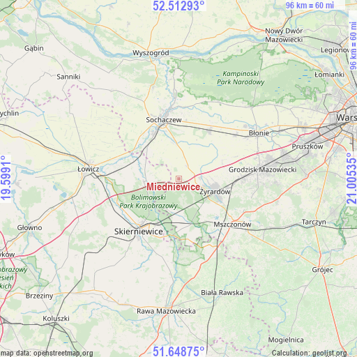
Miedniewice GPS coordinates[2]
52° 4' 58.548" North, 20° 18' 7.992" East
| Map corner | latitude | longitude |
|---|---|---|
| Upper-left | 52.51293°, | 19.5991° |
| Center: | 52.08293°, | 20.30222° |
| Lower-right: | 51.64875°, | 21.00535° |
| Map W x H: | 96.1×96.1 km | = 59.7×59.7mi |
| max Lat: | 54.83135° ⇑32.6% North |
| Miedniewice: | 52.08293° |
| min Lat: | ⇓67.4% South 49.21328° |
| min Long | Miedniewice | max Long |
| 14.20249° | 20.30222° | 24.03723° |
| W 62.6%⇐ | ⇒37.4% E |
Elevation
Elevation of Miedniewice is 96 m = 315 ft, and this is 95.4 m = 313 ft below average elevation for this country.
| Max E: |
974 m = 3196 ft | 81.8% |
| Avg. | 191.4 m = 628 ft | |
| Miedniewice | 96 m = 315 ft | |
Min E: |
-3 m = -10 ft | 18.2% |
See also: Poland elevation on elevation.city.
Geographical zone
Miedniewice is located in North temperate zone (between Tropic of Cancer and the Arctic Circle). Distance of this North polar circle is 1610.1 km =1000.5 mi to North.| Distance of | km | miles | from Miedniewice |
|---|---|---|---|
| North Pole | 4216 | 2619.7 | to North |
| Arctic Circle | 1610.1 | 1000.5 | to North |
| Tropic Cancer | 3185.2 | 1979.2 | to South |
| Equator | 5791.1 | 3598.4 | to South |


Nearby cities:
15 places around Miedniewice: (largest is in red/bold)
• Bolimów
9.5 km =5.9 mi,  265°
265°
• Czerwonka-Parcel
15 km =9.3 mi,  350°
350°
• Franciszków
7.1 km =4.4 mi,  164°
164°
• Guzów
4.4 km =2.7 mi,  32°
32°
• Jaktorów
16.6 km =10.3 mi,  91°
91°
• Jesionka
7.5 km =4.7 mi,  151°
151°
• Kozłów Biskupi
14.2 km =8.8 mi,  328°
328°
• Miedniewice
15.8 km =9.8 mi,  207°
207°
• Mrozy
8.3 km =5.2 mi, 147°
• Nieborów
15.9 km =9.9 mi, 267°
• Paprotnia
15.9 km =9.9 mi, 31°
• Puszcza Mariańska
12 km =7.5 mi, 164°
• Teresin
15.1 km =9.4 mi, 31°
• Wiskitki
5.8 km =3.6 mi,  84°
84°
• Żyrardów
10.5 km =6.5 mi,  111°
111°
Sources, notices
• [Note1] Compared only with cities in Poland existing in our database
• [Src1] Map data: © OpenStreetMap contributors (CC-BY-SA)
• [Src2] Other city data from geonames.org with taken over terms of usage.
• [Src3] Geographical zone / Annual Mean Temperature by Robert A. Rohde @ Wikipedia
