Luborzyca geodata
Luborzyca (Lesser Poland) is a populated place; located in Poland in Europe/Warsaw (GMT+2) time zone. With population of 590 people, there are 3306 cities with bigger population in this country. Compared to other cities in Poland, 76.6% of cities are located further ↑North; 60.3% of cities are located further ←West and 85.4% of cities have lower elevation than Luborzyca. Note1
Administrative division(s):
- Level 1: Lesser Poland
- Level 2: Powiat krakowski
- Level 3: Kocmyrzów-Luborzyca


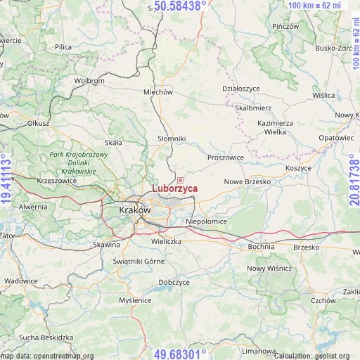
Luborzyca GPS coordinates[2]
50° 8' 8.952" North, 20° 6' 51.3" East
| Map corner | latitude | longitude |
|---|---|---|
| Upper-left | 50.58438°, | 19.41113° |
| Center: | 50.13582°, | 20.11425° |
| Lower-right: | 49.68301°, | 20.81738° |
| Map W x H: | 100.2×100.2 km | = 62.3×62.3mi |
| max Lat: | 54.83135° ⇑76.6% North |
| Luborzyca: | 50.13582° |
| min Lat: | ⇓23.4% South 49.21328° |
| min Long | Luborzyca | max Long |
| 14.20249° | 20.11425° | 24.03723° |
| W 60.3%⇐ | ⇒39.7% E |
Elevation
Elevation of Luborzyca is 292 m = 958 ft, and this is 100.6 m = 330 ft above average elevation for this country.
| Max E: |
974 m = 3196 ft | 14.6% |
| Luborzyca | 292 m 958 ft | |
| Avg. | 191.4 m = 628 ft | |
Min E: |
-3 m = -10 ft | 85.4% |
See also: Poland elevation on elevation.city.
Geographical zone
Luborzyca is located in North temperate zone (between Tropic of Cancer and the Arctic Circle). Distance of this North polar circle is 1826.6 km =1135 mi to North.| Distance of | km | miles | from Luborzyca |
|---|---|---|---|
| North Pole | 4432.5 | 2754.2 | to North |
| Arctic Circle | 1826.6 | 1135 | to North |
| Tropic Cancer | 2968.7 | 1844.7 | to South |
| Equator | 5574.6 | 3463.9 | to South |


Nearby cities:
15 places around Luborzyca: (largest is in red/bold)
• Baranówka
1.3 km =0.8 mi,  319°
319°
• Dojazdów
1.5 km =0.9 mi,  185°
185°
• Kocmyrzów
1.4 km =0.9 mi,  118°
118°
• Kokotów
13.9 km =8.6 mi, 190°
• Masłomiąca
8.5 km =5.3 mi,  289°
289°
• Michałowice
9.9 km =6.2 mi, 285°
• Miłocice
11.9 km =7.4 mi,  334°
334°
• Niedźwiedź
9.9 km =6.2 mi,  351°
351°
• Niepołomice
13.1 km =8.1 mi,  143°
143°
• Podłęże
14 km =8.7 mi,  164°
164°
• Proszowice
14 km =8.7 mi,  63°
63°
• Słomniki
11.8 km =7.3 mi, 348°
• Wola Batorska
14.2 km =8.8 mi,  130°
130°
• Węgrzce Wielkie
13.4 km =8.3 mi,  181°
181°
• Zielonki
13.8 km =8.6 mi,  263°
263°
Sources, notices
• [Note1] Compared only with cities in Poland existing in our database
• [Src1] Map data: © OpenStreetMap contributors (CC-BY-SA)
• [Src2] Other city data from geonames.org with taken over terms of usage.
• [Src3] Geographical zone / Annual Mean Temperature by Robert A. Rohde @ Wikipedia
