Iwonicz-Zdrój geodata
Iwonicz-Zdrój (Subcarpathian) is a seat of a third-order administrative division; located in Poland in Europe/Warsaw (GMT+2) time zone. With population of 1,860 people, there are 1575 cities with bigger population in this country. Compared to other cities in Poland, 97.4% of cities are located further ↑North; 82.2% of cities are located further ←West and 94.3% of cities have lower elevation than Iwonicz-Zdrój. Note1
Administrative division(s):
- Level 1: Subcarpathian
- Level 2: Powiat krośnieński
- Level 3: Iwonicz-Zdrój


Iwonicz-Zdrój GPS coordinates[2]
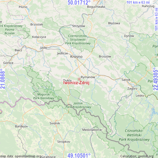
49° 33' 47.484" North, 21° 47' 23.712" East
| Map corner | latitude | longitude |
|---|---|---|
| Upper-left | 50.01712°, | 21.0868° |
| Center: | 49.56319°, | 21.78992° |
| Lower-right: | 49.10501°, | 22.49305° |
| Map W x H: | 101.4×101.4 km | = 63×63mi |
| max Lat: | 54.83135° ⇑97.4% North |
| Iwonicz-Zdrój: | 49.56319° |
| min Lat: | ⇓2.6% South 49.21328° |
| min Long | Iwonicz-Zdrój | max Long |
| 14.20249° | 21.78992° | 24.03723° |
| W 82.2%⇐ | ⇒17.8% E |
Elevation
Elevation of Iwonicz-Zdrój is 401 m = 1316 ft, and this is 209.6 m = 688 ft above average elevation for this country.
| Max E: |
974 m = 3196 ft | 5.7% |
| Iwonicz-Zdrój | 401 m 1316 ft | |
| Avg. | 191.4 m = 628 ft | |
Min E: |
-3 m = -10 ft | 94.3% |
See also: Poland elevation on elevation.city.
Geographical zone
Iwonicz-Zdrój is located in North temperate zone (between Tropic of Cancer and the Arctic Circle). Distance of this North polar circle is 1890.3 km =1174.6 mi to North.| Distance of | km | miles | from Iwonicz-Zdrój |
|---|---|---|---|
| North Pole | 4496.2 | 2793.8 | to North |
| Arctic Circle | 1890.3 | 1174.6 | to North |
| Tropic Cancer | 2905 | 1805.1 | to South |
| Equator | 5510.9 | 3424.3 | to South |


Nearby cities:
15 places around Iwonicz-Zdrój: (largest is in red/bold)
• Besko
12.1 km =7.5 mi,  77°
77°
• Chorkówka
12.6 km =7.8 mi,  317°
317°
• Dukla
7.7 km =4.8 mi,  263°
263°
• Głębokie
8.9 km =5.5 mi,  102°
102°
• Haczów
13.4 km =8.3 mi,  35°
35°
• Jabłonica Polska
16.9 km =10.5 mi,  27°
27°
• Jasionów
17.1 km =10.6 mi,  51°
51°
• Jaśliska
13.5 km =8.4 mi,  174°
174°
• Korczyna
17 km =10.6 mi,  4°
4°
• Krosno
14 km =8.7 mi,  354°
354°
• Krościenko Wyżne
13.2 km =8.2 mi,  12°
12°
• Miejsce Piastowe
7.9 km =4.9 mi,  358°
358°
• Rymanów
5.8 km =3.6 mi, 75°
• Sieniawa
9.9 km =6.2 mi,  88°
88°
• Zarszyn
16.2 km =10.1 mi, 82°
Sources, notices
• [Note1] Compared only with cities in Poland existing in our database
• [Src1] Map data: © OpenStreetMap contributors (CC-BY-SA)
• [Src2] Other city data from geonames.org with taken over terms of usage.
• [Src3] Geographical zone / Annual Mean Temperature by Robert A. Rohde @ Wikipedia
