Duczki geodata
Duczki (Mazovia) is a populated place; located in Poland in Europe/Warsaw (GMT+2) time zone. With population of 2,500 people, there are 1240 cities with bigger population in this country. Compared to other cities in Poland, 73.9% of cities are located further ↓South; 76.8% of cities are located further ←West and 81.2% of cities have higher elevation than Duczki. Note1


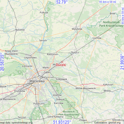
Duczki GPS coordinates[2]
52° 21' 45.756" North, 21° 17' 25.692" East
| Map corner | latitude | longitude |
|---|---|---|
| Upper-left | 52.79°, | 20.58735° |
| Center: | 52.36271°, | 21.29047° |
| Lower-right: | 51.93125°, | 21.9936° |
| Map W x H: | 95.5×95.5 km | = 59.3×59.3mi |
| max Lat: | 54.83135° ⇑26.1% North |
| Duczki: | 52.36271° |
| min Lat: | ⇓73.9% South 49.21328° |
| min Long | Duczki | max Long |
| 14.20249° | 21.29047° | 24.03723° |
| W 76.8%⇐ | ⇒23.2% E |
Elevation
Elevation of Duczki is 97 m = 318 ft, and this is 94.4 m = 310 ft below average elevation for this country.
| Max E: |
974 m = 3196 ft | 81.2% |
| Avg. | 191.4 m = 628 ft | |
| Duczki | 97 m = 318 ft | |
Min E: |
-3 m = -10 ft | 18.8% |
See also: Poland elevation on elevation.city.
Geographical zone
Duczki is located in North temperate zone (between Tropic of Cancer and the Arctic Circle). Distance of this North polar circle is 1579 km =981.1 mi to North.| Distance of | km | miles | from Duczki |
|---|---|---|---|
| North Pole | 4184.9 | 2600.4 | to North |
| Arctic Circle | 1579 | 981.1 | to North |
| Tropic Cancer | 3216.3 | 1998.5 | to South |
| Equator | 5822.2 | 3617.7 | to South |


Nearby cities:
15 places around Duczki: (largest is in red/bold)
• Czarna
4.4 km =2.7 mi,  278°
278°
• Jasienica
10 km =6.2 mi,  55°
55°
• Klembów
5.6 km =3.5 mi,  29°
29°
• Kobyłka
6.9 km =4.3 mi,  248°
248°
• Nowe Lipiny
1.4 km =0.9 mi, 247°
• Ostrówek
6 km =3.7 mi, 60°
• Poświętne
9.6 km =6 mi,  112°
112°
• Radzymin
9.3 km =5.8 mi,  309°
309°
• Stare Grabie
2.1 km =1.3 mi,  67°
67°
• Sulejówek
12.4 km =7.7 mi,  186°
186°
• Słupno
9.5 km =5.9 mi, 284°
• Tłuszcz
12.4 km =7.7 mi,  52°
52°
• Wesoła
12.8 km =8 mi,  200°
200°
• Wołomin
4.1 km =2.5 mi,  232°
232°
• Zielonka
11 km =6.8 mi, 233°
Sources, notices
• [Note1] Compared only with cities in Poland existing in our database
• [Src1] Map data: © OpenStreetMap contributors (CC-BY-SA)
• [Src2] Other city data from geonames.org with taken over terms of usage.
• [Src3] Geographical zone / Annual Mean Temperature by Robert A. Rohde @ Wikipedia
