Wołomin geodata
Wołomin (Mazovia) is a seat of a second-order administrative division; located in Poland in Europe/Warsaw (GMT+2) time zone. With population of 36,592 people, there are 143 cities with bigger population in this country. Compared to other cities in Poland, 73.5% of cities are located further ↓South; 76.3% of cities are located further ←West and 81.8% of cities have higher elevation than Wołomin. Note1


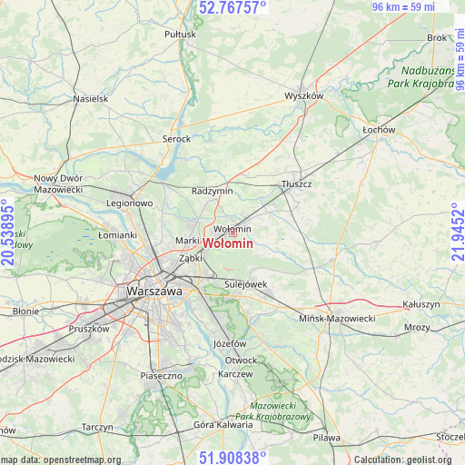
Wołomin GPS coordinates[2]
52° 20' 24.216" North, 21° 14' 31.452" East
| Map corner | latitude | longitude |
|---|---|---|
| Upper-left | 52.76757°, | 20.53895° |
| Center: | 52.34006°, | 21.24207° |
| Lower-right: | 51.90838°, | 21.9452° |
| Map W x H: | 95.5×95.5 km | = 59.3×59.3mi |
| max Lat: | 54.83135° ⇑26.5% North |
| Wołomin: | 52.34006° |
| min Lat: | ⇓73.5% South 49.21328° |
| min Long | Wołomin | max Long |
| 14.20249° | 21.24207° | 24.03723° |
| W 76.3%⇐ | ⇒23.7% E |
Elevation
Elevation of Wołomin is 96 m = 315 ft, and this is 95.4 m = 313 ft below average elevation for this country.
| Max E: |
974 m = 3196 ft | 81.8% |
| Avg. | 191.4 m = 628 ft | |
| Wołomin | 96 m = 315 ft | |
Min E: |
-3 m = -10 ft | 18.2% |
See also: Poland elevation on elevation.city.
Geographical zone
Wołomin is located in North temperate zone (between Tropic of Cancer and the Arctic Circle). Distance of this North polar circle is 1581.5 km =982.7 mi to North.| Distance of | km | miles | from Wołomin |
|---|---|---|---|
| North Pole | 4187.4 | 2601.9 | to North |
| Arctic Circle | 1581.5 | 982.7 | to North |
| Tropic Cancer | 3213.8 | 1997 | to South |
| Equator | 5819.7 | 3616.2 | to South |


Nearby cities:
15 places around Wołomin: (largest is in red/bold)
• Czarna
3.3 km =2.1 mi,  341°
341°
• Duczki
4.1 km =2.5 mi,  52°
52°
• Klembów
9.6 km =6 mi,  39°
39°
• Kobyłka
3.1 km =1.9 mi,  268°
268°
• Marki
9.6 km =6 mi,  256°
256°
• Nowe Lipiny
2.8 km =1.7 mi, 44°
• Ostrówek
10.1 km =6.3 mi,  57°
57°
• Radzymin
9.3 km =5.8 mi, 335°
• Rembertów
10.3 km =6.4 mi,  211°
211°
• Stare Grabie
6.2 km =3.9 mi, 57°
• Sulejówek
9.9 km =6.2 mi,  169°
169°
• Słupno
7.6 km =4.7 mi,  309°
309°
• Wesoła
9.6 km =6 mi,  187°
187°
• Zielonka
6.9 km =4.3 mi,  234°
234°
• Ząbki
10.7 km =6.6 mi,  240°
240°
Sources, notices
• [Note1] Compared only with cities in Poland existing in our database
• [Src1] Map data: © OpenStreetMap contributors (CC-BY-SA)
• [Src2] Other city data from geonames.org with taken over terms of usage.
• [Src3] Geographical zone / Annual Mean Temperature by Robert A. Rohde @ Wikipedia
