Camuy geodata
Camuy is a seat of a first-order administrative division; located in Puerto Rico in America/Puerto_Rico (GMT-4) time zone. With population of 4,240 people, there are 82 cities with bigger population in this country. Compared to other cities in Puerto Rico, 98.7% of cities are located further ↓South; 79.1% of cities are located further →East and 81.3% of cities have higher elevation than Camuy. Note1


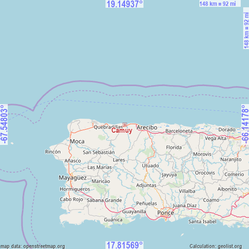
Camuy GPS coordinates[2]
18° 29' 1.788" North, 66° 50' 41.64" West
| Map corner | latitude | longitude |
|---|---|---|
| Upper-left | 19.14937°, | -67.54803° |
| Center: | 18.48383°, | -66.8449° |
| Lower-right: | 17.81569°, | -66.14178° |
| Map W x H: | 148.3×148.3 km | = 92.1×92.1mi |
| max Lat: | 18.50078° ⇑1.3% North |
| Camuy: | 18.48383° |
| min Lat: | ⇓98.7% South 17.95358° |
| min Long | Camuy | max Long |
| -67.2499° | -66.8449° | -65.30099° |
| W 20.9%⇐ | ⇒79.1% E |
Elevation
Elevation of Camuy is 14 m = 46 ft, and this is 86.5 m = 284 ft below average elevation for this country.
| Max E: |
655 m = 2149 ft | 81.3% |
| Avg. | 100.5 m = 330 ft | |
| Camuy | 14 m = 46 ft | |
Min E: |
1 m = 3 ft | 18.7% |
See also: Puerto Rico elevation on elevation.city.
Geographical zone
Camuy is located in North Torrid zone (between Equator and Tropic of Cancer). Distance of this Northern Tropic circle is 550.7 km =342.2 mi to North.| Distance of | km | miles | from Camuy |
|---|---|---|---|
| North Pole | 7951.9 | 4941.1 | to North |
| Arctic Circle | 5346 | 3321.8 | to North |
| Tropic Cancer | 550.7 | 342.2 | to North |
| Equator | 2055.2 | 1277 | to South |


Nearby cities:
15 places around Camuy: (largest is in red/bold)
• Arecibo
13.7 km =8.5 mi,  95°
95°
• Bajadero
18.2 km =11.3 mi,  110°
110°
• Cacao
11.1 km =6.9 mi,  241°
241°
• Carrizales
5.8 km =3.6 mi,  92°
92°
• Corcovado
7.8 km =4.8 mi, 111°
• Hatillo
2.1 km =1.3 mi,  82°
82°
• Isabela
19 km =11.8 mi,  275°
275°
• Juncal
20.5 km =12.7 mi,  202°
202°
• Mora
19.9 km =12.4 mi,  263°
263°
• Piedra Gorda
7.1 km =4.4 mi,  219°
219°
• Quebrada
14.2 km =8.8 mi,  174°
174°
• Quebradillas
9.9 km =6.2 mi, 263°
• Rafael Capo
10.8 km =6.7 mi,  142°
142°
• Rafael Gonzalez
8.8 km =5.5 mi, 135°
• San Antonio
11.6 km =7.2 mi,  252°
252°
Sources, notices
• [Note1] Compared only with cities in Puerto Rico existing in our database
• [Src1] Map data: © OpenStreetMap contributors (CC-BY-SA)
• [Src2] Other city data from geonames.org with taken over terms of usage.
• [Src3] Geographical zone / Annual Mean Temperature by Robert A. Rohde @ Wikipedia
