Punta Santiago geodata
Punta Santiago (Humacao) is a populated place; located in Puerto Rico in America/Puerto_Rico (GMT-4) time zone. With population of 5,803 people, there are 60 cities with bigger population in this country. Compared to other cities in Puerto Rico, 61.3% of cities are located further ↑North; 94.2% of cities are located further ←West and 97.3% of cities have higher elevation than Punta Santiago. Note1


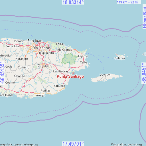
Punta Santiago GPS coordinates[2]
18° 9' 58.86" North, 65° 44' 53.592" West
| Map corner | latitude | longitude |
|---|---|---|
| Upper-left | 18.83314°, | -66.45135° |
| Center: | 18.16635°, | -65.74822° |
| Lower-right: | 17.49701°, | -65.0451° |
| Map W x H: | 148.6×148.6 km | = 92.3×92.3mi |
| max Lat: | 18.50078° ⇑61.3% North |
| Punta Santiago: | 18.16635° |
| min Lat: | ⇓38.7% South 17.95358° |
| min Long | Punta Santiago | max Long |
| -67.2499° | -65.74822° | -65.30099° |
| W 94.2%⇐ | ⇒5.8% E |
Elevation
Elevation of Punta Santiago is 4 m = 13 ft, and this is 96.5 m = 317 ft below average elevation for this country.
| Max E: |
655 m = 2149 ft | 97.3% |
| Avg. | 100.5 m = 330 ft | |
| Punta Santiago | 4 m = 13 ft | |
Min E: |
1 m = 3 ft | 2.7% |
See also: Puerto Rico elevation on elevation.city.
Geographical zone
Punta Santiago is located in North Torrid zone (between Equator and Tropic of Cancer). Distance of this Northern Tropic circle is 586 km =364.1 mi to North.| Distance of | km | miles | from Punta Santiago |
|---|---|---|---|
| North Pole | 7987.2 | 4963 | to North |
| Arctic Circle | 5381.3 | 3343.8 | to North |
| Tropic Cancer | 586 | 364.1 | to North |
| Equator | 2019.9 | 1255.1 | to South |


Nearby cities:
15 places around Punta Santiago: (largest is in red/bold)
• Aguas Claras
13.9 km =8.6 mi,  46°
46°
• Antón Ruiz
6.7 km =4.2 mi,  288°
288°
• Bajandas
3.6 km =2.2 mi,  254°
254°
• Boqueron
11.5 km =7.1 mi, 293°
• Candelero Arriba
11.8 km =7.3 mi,  232°
232°
• Comunas
13.4 km =8.3 mi, 228°
• Daguao
9.6 km =6 mi, 45°
• Duque
7.9 km =4.9 mi,  5°
5°
• Humacao
8.6 km =5.3 mi,  257°
257°
• La Fermina
11.2 km =7 mi,  275°
275°
• Las Piedras
12.6 km =7.8 mi, 278°
• Naguabo
5.2 km =3.2 mi,  15°
15°
• Peña Pobre
9.5 km =5.9 mi,  305°
305°
• Pueblito del Rio
13.9 km =8.6 mi,  299°
299°
• Río Blanco
7.2 km =4.5 mi,  323°
323°
Sources, notices
• [Note1] Compared only with cities in Puerto Rico existing in our database
• [Src1] Map data: © OpenStreetMap contributors (CC-BY-SA)
• [Src2] Other city data from geonames.org with taken over terms of usage.
• [Src3] Geographical zone / Annual Mean Temperature by Robert A. Rohde @ Wikipedia
