Vila do Bispo geodata
Vila do Bispo (Faro) is a seat of a second-order administrative division; located in Portugal in Europe/Lisbon (GMT+1) time zone. With population of 1,000 people, there are 751 cities with bigger population in this country. Compared to other cities in Portugal, 95.4% of cities are located further ↑North; 71.5% of cities are located further →East and 58.9% of cities have higher elevation than Vila do Bispo. Note1


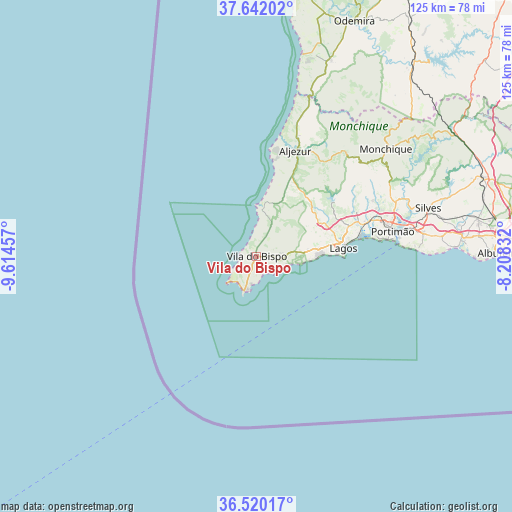
Vila do Bispo GPS coordinates[2]
37° 4' 59.412" North, 8° 54' 41.184" West
| Map corner | latitude | longitude |
|---|---|---|
| Upper-left | 37.64202°, | -9.61457° |
| Center: | 37.08317°, | -8.91144° |
| Lower-right: | 36.52017°, | -8.20832° |
| Map W x H: | 124.7×124.7 km | = 77.5×77.5mi |
| max Lat: | 42.11337° ⇑95.4% North |
| Vila do Bispo: | 37.08317° |
| min Lat: | ⇓4.6% South 32.6448° |
| min Long | Vila do Bispo | max Long |
| -31.17847° | -8.91144° | -6.27308° |
| W 28.5%⇐ | ⇒71.5% E |
Elevation
Elevation of Vila do Bispo is 81 m = 266 ft, and this is 96 m = 315 ft below average elevation for this country.
| Max E: |
1008 m = 3307 ft | 58.9% |
| Avg. | 177 m = 581 ft | |
| Vila do Bispo | 81 m = 266 ft | |
Min E: |
-128 m = -420 ft | 41.1% |
See also: Portugal elevation on elevation.city.
Geographical zone
Vila do Bispo is located in North temperate zone (between Tropic of Cancer and the Arctic Circle). Distance of this Northern Tropic circle is 1517.3 km =942.8 mi to South.| Distance of | km | miles | from Vila do Bispo |
|---|---|---|---|
| North Pole | 5883.8 | 3656 | to North |
| Arctic Circle | 3277.9 | 2036.8 | to North |
| Tropic Cancer | 1517.3 | 942.8 | to South |
| Equator | 4123.3 | 2562.1 | to South |


Nearby cities:
15 places around Vila do Bispo: (largest is in red/bold)
• Aljezur
27.8 km =17.3 mi,  20°
20°
• Alvor
28.8 km =17.9 mi,  79°
79°
• Barão de São João
13.4 km =8.3 mi,  62°
62°
• Bensafrim
17.6 km =10.9 mi, 62°
• Carvoeiro
39.3 km =24.4 mi,  87°
87°
• Estômbar
38.5 km =23.9 mi, 79°
• Ferragudo
35.1 km =21.8 mi, 82°
• Lagos
21.1 km =13.1 mi, 84°
• Marmelete
33.2 km =20.6 mi,  40°
40°
• Mexilhoeira Grande
27.6 km =17.1 mi,  72°
72°
• Odeceixe
40.8 km =25.4 mi, 17°
• Parchal
35.5 km =22.1 mi, 80°
• Portimão
33.7 km =20.9 mi, 79°
• Sagres
8.8 km =5.5 mi,  198°
198°
• Senhora da Luz
16.4 km =10.2 mi, 88°
Sources, notices
• [Note1] Compared only with cities in Portugal existing in our database
• [Src1] Map data: © OpenStreetMap contributors (CC-BY-SA)
• [Src2] Other city data from geonames.org with taken over terms of usage.
• [Src3] Geographical zone / Annual Mean Temperature by Robert A. Rohde @ Wikipedia
