Idanha-a-Nova geodata
Idanha-a-Nova (Castelo Branco) is a seat of a second-order administrative division; located in Portugal in Europe/Lisbon (GMT+1) time zone. In our database, there are 824 cities with bigger population. Compared to other cities in Portugal, 53.1% of cities are located further ↓South; 97.2% of cities are located further ←West and 86.4% of cities have lower elevation than Idanha-a-Nova. Note1


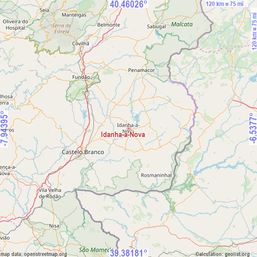
Idanha-a-Nova GPS coordinates[2]
39° 55' 23.376" North, 7° 14' 26.952" West
| Map corner | latitude | longitude |
|---|---|---|
| Upper-left | 40.46026°, | -7.94395° |
| Center: | 39.92316°, | -7.24082° |
| Lower-right: | 39.38181°, | -6.5377° |
| Map W x H: | 119.9×119.9 km | = 74.5×74.5mi |
| max Lat: | 42.11337° ⇑46.9% North |
| Idanha-a-Nova: | 39.92316° |
| min Lat: | ⇓53.1% South 32.6448° |
| min Long | Idanha-a-Nova | max Long |
| -31.17847° | -7.24082° | -6.27308° |
| W 97.2%⇐ | ⇒2.8% E |
Elevation
Elevation of Idanha-a-Nova is 387 m = 1270 ft, and this is 210 m = 689 ft above average elevation for this country.
| Max E: |
1008 m = 3307 ft | 13.6% |
| Idanha-a-Nova | 387 m 1270 ft | |
| Avg. | 177 m = 581 ft | |
Min E: |
-128 m = -420 ft | 86.4% |
See also: Portugal elevation on elevation.city.
Geographical zone
Idanha-a-Nova is located in North temperate zone (between Tropic of Cancer and the Arctic Circle). Distance of this Northern Tropic circle is 1833.1 km =1139 mi to South.| Distance of | km | miles | from Idanha-a-Nova |
|---|---|---|---|
| North Pole | 5568 | 3459.8 | to North |
| Arctic Circle | 2962.1 | 1840.6 | to North |
| Tropic Cancer | 1833.1 | 1139 | to South |
| Equator | 4439 | 2758.3 | to South |


Nearby cities:
15 places around Idanha-a-Nova: (largest is in red/bold)
• Alcains
18.4 km =11.4 mi,  267°
267°
• Aldeia de Joanes
33.6 km =20.9 mi,  315°
315°
• Barco
41.9 km =26 mi,  311°
311°
• Barroca Grande
50.3 km =31.3 mi,  300°
300°
• Belmonte
49.4 km =30.7 mi,  349°
349°
• Castelo Branco
24.1 km =15 mi,  242°
242°
• Covilhã
45.7 km =28.4 mi,  330°
330°
• Fundão
32.8 km =20.4 mi, 317°
• Monsanto
16.8 km =10.4 mi,  39°
39°
• Penamacor
28 km =17.4 mi,  12°
12°
• Póvoa e Meadas
51.6 km =32.1 mi,  207°
207°
• Sabugal
49.3 km =30.6 mi, 14°
• Teixoso
47.3 km =29.4 mi,  337°
337°
• Vales do Rio
40.4 km =25.1 mi, 320°
• Vila Velha de Ródão
47.6 km =29.6 mi,  231°
231°
Sources, notices
• [Note1] Compared only with cities in Portugal existing in our database
• [Src1] Map data: © OpenStreetMap contributors (CC-BY-SA)
• [Src2] Other city data from geonames.org with taken over terms of usage.
• [Src3] Geographical zone / Annual Mean Temperature by Robert A. Rohde @ Wikipedia
