Almograve geodata
Almograve (Beja) is a populated place; located in Portugal in Europe/Lisbon (GMT+1) time zone. With population of 1,356 people, there are 704 cities with bigger population in this country. Compared to other cities in Portugal, 88.8% of cities are located further ↑North; 68.2% of cities are located further →East and 84.7% of cities have higher elevation than Almograve. Note1


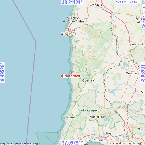
Almograve GPS coordinates[2]
37° 39' 23.94" North, 8° 47' 31.704" West
| Map corner | latitude | longitude |
|---|---|---|
| Upper-left | 38.21121°, | -9.49526° |
| Center: | 37.65665°, | -8.79214° |
| Lower-right: | 37.09791°, | -8.08901° |
| Map W x H: | 123.8×123.8 km | = 76.9×76.9mi |
| max Lat: | 42.11337° ⇑88.8% North |
| Almograve: | 37.65665° |
| min Lat: | ⇓11.2% South 32.6448° |
| min Long | Almograve | max Long |
| -31.17847° | -8.79214° | -6.27308° |
| W 31.8%⇐ | ⇒68.2% E |
Elevation
Elevation of Almograve is 24 m = 79 ft, and this is 153 m = 502 ft below average elevation for this country.
| Max E: |
1008 m = 3307 ft | 84.7% |
| Avg. | 177 m = 581 ft | |
| Almograve | 24 m = 79 ft | |
Min E: |
-128 m = -420 ft | 15.3% |
See also: Portugal elevation on elevation.city.
Geographical zone
Almograve is located in North temperate zone (between Tropic of Cancer and the Arctic Circle). Distance of this Northern Tropic circle is 1581.1 km =982.4 mi to South.| Distance of | km | miles | from Almograve |
|---|---|---|---|
| North Pole | 5820 | 3616.4 | to North |
| Arctic Circle | 3214.1 | 1997.1 | to North |
| Tropic Cancer | 1581.1 | 982.4 | to South |
| Equator | 4187 | 2601.7 | to South |


Nearby cities:
15 places around Almograve: (largest is in red/bold)
• Aljezur
37.7 km =23.4 mi,  181°
181°
• Boavista dos Pinheiros
14.1 km =8.8 mi,  126°
126°
• Cercal
19.1 km =11.9 mi,  32°
32°
• Marmelete
40.1 km =24.9 mi,  164°
164°
• Monchique
43.1 km =26.8 mi,  150°
150°
• Odeceixe
25 km =15.5 mi, 175°
• Odemira
14.9 km =9.3 mi,  115°
115°
• Porto Covo
21.8 km =13.5 mi,  0°
0°
• Santiago do Cacém
41 km =25.5 mi,  12°
12°
• Santo André
44.9 km =27.9 mi, 1°
• Sines
34 km =21.1 mi,  348°
348°
• São Luis
13 km =8.1 mi,  59°
59°
• São Teotónio
17.7 km =11 mi, 154°
• Vila Nova de Milfontes
7.5 km =4.7 mi, 6°
• Zambujeira do Mar
14.3 km =8.9 mi, 177°
Sources, notices
• [Note1] Compared only with cities in Portugal existing in our database
• [Src1] Map data: © OpenStreetMap contributors (CC-BY-SA)
• [Src2] Other city data from geonames.org with taken over terms of usage.
• [Src3] Geographical zone / Annual Mean Temperature by Robert A. Rohde @ Wikipedia
