Sines geodata
Sines (District of Setúbal) is a seat of a second-order administrative division; located in Portugal in Europe/Lisbon (GMT+1) time zone. With population of 12,791 people, there are 158 cities with bigger population in this country. Compared to other cities in Portugal, 84.5% of cities are located further ↑North; 70.7% of cities are located further →East and 75.2% of cities have higher elevation than Sines. Note1


Sines GPS coordinates[2]
37° 57' 22.392" North, 8° 52' 11.244" West
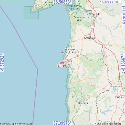
| Map corner | latitude | longitude |
|---|---|---|
| Upper-left | 38.50853°, | -9.57292° |
| Center: | 37.95622°, | -8.86979° |
| Lower-right: | 37.39973°, | -8.16667° |
| Map W x H: | 123.3×123.3 km | = 76.6×76.6mi |
| max Lat: | 42.11337° ⇑84.5% North |
| Sines: | 37.95622° |
| min Lat: | ⇓15.5% South 32.6448° |
| min Long | Sines | max Long |
| -31.17847° | -8.86979° | -6.27308° |
| W 29.3%⇐ | ⇒70.7% E |
Elevation
Elevation of Sines is 40 m = 131 ft, and this is 137 m = 449 ft below average elevation for this country.
| Max E: |
1008 m = 3307 ft | 75.2% |
| Avg. | 177 m = 581 ft | |
| Sines | 40 m = 131 ft | |
Min E: |
-128 m = -420 ft | 24.8% |
See also: Portugal elevation on elevation.city.
Geographical zone
Sines is located in North temperate zone (between Tropic of Cancer and the Arctic Circle). Distance of this Northern Tropic circle is 1614.4 km =1003.1 mi to South.| Distance of | km | miles | from Sines |
|---|---|---|---|
| North Pole | 5786.7 | 3595.7 | to North |
| Arctic Circle | 3180.8 | 1976.5 | to North |
| Tropic Cancer | 1614.4 | 1003.1 | to South |
| Equator | 4220.3 | 2622.4 | to South |


Nearby cities:
15 places around Sines: (largest is in red/bold)
• Alcácer do Sal
55.8 km =34.7 mi,  33°
33°
• Almograve
34 km =21.1 mi,  168°
168°
• Boavista dos Pinheiros
45.5 km =28.3 mi,  156°
156°
• Cercal
24.3 km =15.1 mi,  135°
135°
• Comporta
47.7 km =29.6 mi,  8°
8°
• Grândola
36.2 km =22.5 mi,  47°
47°
• Odemira
44.7 km =27.8 mi,  153°
153°
• Porto Covo
13.5 km =8.4 mi, 148°
• Santiago do Cacém
16.8 km =10.4 mi,  66°
66°
• Santo André
13.9 km =8.6 mi, 33°
• Sesimbra
57.9 km =36 mi,  339°
339°
• São Luis
32.3 km =20.1 mi, 146°
• São Teotónio
51.3 km =31.9 mi, 163°
• Vila Nova de Milfontes
27 km =16.8 mi, 163°
• Zambujeira do Mar
48.2 km =30 mi, 171°
Sources, notices
• [Note1] Compared only with cities in Portugal existing in our database
• [Src1] Map data: © OpenStreetMap contributors (CC-BY-SA)
• [Src2] Other city data from geonames.org with taken over terms of usage.
• [Src3] Geographical zone / Annual Mean Temperature by Robert A. Rohde @ Wikipedia
