Samil geodata
Samil (Bragança) is a populated place; located in Portugal in Europe/Lisbon (GMT+1) time zone. With population of 1,246 people, there are 721 cities with bigger population in this country. Compared to other cities in Portugal, 98.3% of cities are located further ↓South; 99.4% of cities are located further ←West and 98.3% of cities have lower elevation than Samil. Note1


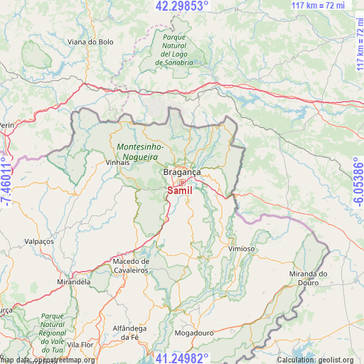
Samil GPS coordinates[2]
41° 46' 34.752" North, 6° 45' 25.128" West
| Map corner | latitude | longitude |
|---|---|---|
| Upper-left | 42.29853°, | -7.46011° |
| Center: | 41.77632°, | -6.75698° |
| Lower-right: | 41.24982°, | -6.05386° |
| Map W x H: | 116.6×116.6 km | = 72.5×72.5mi |
| max Lat: | 42.11337° ⇑1.7% North |
| Samil: | 41.77632° |
| min Lat: | ⇓98.3% South 32.6448° |
| min Long | Samil | max Long |
| -31.17847° | -6.75698° | -6.27308° |
| W 99.4%⇐ | ⇒0.59999999999999% E |
Elevation
Elevation of Samil is 750 m = 2461 ft, and this is 573 m = 1880 ft above average elevation for this country.
| Max E: |
1008 m = 3307 ft | 1.7% |
| Samil | 750 m 2461 ft | |
| Avg. | 177 m = 581 ft | |
Min E: |
-128 m = -420 ft | 98.3% |
See also: Portugal elevation on elevation.city.
Geographical zone
Samil is located in North temperate zone (between Tropic of Cancer and the Arctic Circle). Distance of this Northern Tropic circle is 2039.2 km =1267.1 mi to South.| Distance of | km | miles | from Samil |
|---|---|---|---|
| North Pole | 5362 | 3331.8 | to North |
| Arctic Circle | 2756.1 | 1712.6 | to North |
| Tropic Cancer | 2039.2 | 1267.1 | to South |
| Equator | 4645.1 | 2886.3 | to South |


Nearby cities:
15 places around Samil: (largest is in red/bold)
• Alfândega da Fé
51.1 km =31.8 mi,  199°
199°
• Bragança
3.3 km =2.1 mi,  359°
359°
• Chaves
59.2 km =36.8 mi,  266°
266°
• Lagoaça
65 km =40.4 mi,  177°
177°
• Macedo de Cavaleiros
31.4 km =19.5 mi,  212°
212°
• Miranda do Douro
50.8 km =31.6 mi,  127°
127°
• Mirandela
48.1 km =29.9 mi,  228°
228°
• Mogadouro
48.6 km =30.2 mi, 175°
• Murça
71.2 km =44.2 mi, 234°
• Santa Cruz
59 km =36.7 mi, 268°
• Sendim
51.3 km =31.9 mi,  147°
147°
• Valpaços
49.7 km =30.9 mi,  247°
247°
• Vila Flor
61.6 km =38.3 mi, 212°
• Vimioso
28.6 km =17.8 mi,  138°
138°
• Vinhais
21.6 km =13.4 mi,  287°
287°
Sources, notices
• [Note1] Compared only with cities in Portugal existing in our database
• [Src1] Map data: © OpenStreetMap contributors (CC-BY-SA)
• [Src2] Other city data from geonames.org with taken over terms of usage.
• [Src3] Geographical zone / Annual Mean Temperature by Robert A. Rohde @ Wikipedia
