Peso da Régua geodata
Peso da Régua (Vila Real) is a seat of a second-order administrative division; located in Portugal in Europe/Lisbon (GMT+1) time zone. With population of 5,048 people, there are 417 cities with bigger population in this country. Compared to other cities in Portugal, 76.6% of cities are located further ↓South; 85.6% of cities are located further ←West and 58.5% of cities have lower elevation than Peso da Régua. Note1


Peso da Régua GPS coordinates[2]
41° 9' 53.676" North, 7° 47' 13.308" West
| Map corner | latitude | longitude |
|---|---|---|
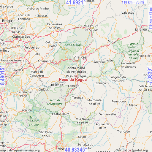
| Upper-left | 41.6921°, | -8.49015° |
| Center: | 41.16491°, | -7.78703° |
| Lower-right: | 40.63345°, | -7.0839° |
| Map W x H: | 117.7×117.7 km | = 73.1×73.1mi |
| max Lat: | 42.11337° ⇑23.4% North |
| Peso da Régua: | 41.16491° |
| min Lat: | ⇓76.6% South 32.6448° |
| min Long | Peso da Régua | max Long |
| -31.17847° | -7.78703° | -6.27308° |
| W 85.6%⇐ | ⇒14.4% E |
Elevation
Elevation of Peso da Régua is 146 m = 479 ft, and this is 31 m = 102 ft below average elevation for this country.
| Max E: |
1008 m = 3307 ft | 41.5% |
| Avg. | 177 m = 581 ft | |
| Peso da Régua | 146 m = 479 ft | |
Min E: |
-128 m = -420 ft | 58.5% |
See also: Portugal elevation on elevation.city.
Geographical zone
Peso da Régua is located in North temperate zone (between Tropic of Cancer and the Arctic Circle). Distance of this Northern Tropic circle is 1971.2 km =1224.8 mi to South.| Distance of | km | miles | from Peso da Régua |
|---|---|---|---|
| North Pole | 5430 | 3374 | to North |
| Arctic Circle | 2824.1 | 1754.8 | to North |
| Tropic Cancer | 1971.2 | 1224.8 | to South |
| Equator | 4577.1 | 2844.1 | to South |


Nearby cities:
15 places around Peso da Régua: (largest is in red/bold)
• Armamar
10.2 km =6.3 mi,  128°
128°
• Britiande
11.4 km =7.1 mi,  182°
182°
• Fontelo
6.9 km =4.3 mi,  136°
136°
• Godim
1.5 km =0.9 mi,  296°
296°
• Lalim
14.2 km =8.8 mi,  189°
189°
• Lamego
7.7 km =4.8 mi, 194°
• Mesão Frio
8.6 km =5.3 mi,  266°
266°
• Mondim da Beira
16.5 km =10.3 mi,  167°
167°
• Resende
16.4 km =10.2 mi,  246°
246°
• Santa Marta de Penaguião
5 km =3.1 mi,  3°
3°
• Tabuaço
19.1 km =11.9 mi,  106°
106°
• Tarouca
16.4 km =10.2 mi, 176°
• Valadares
16.4 km =10.2 mi,  263°
263°
• Vila Real
15.5 km =9.6 mi,  13°
13°
• Vilela
16.8 km =10.4 mi,  66°
66°
Sources, notices
• [Note1] Compared only with cities in Portugal existing in our database
• [Src1] Map data: © OpenStreetMap contributors (CC-BY-SA)
• [Src2] Other city data from geonames.org with taken over terms of usage.
• [Src3] Geographical zone / Annual Mean Temperature by Robert A. Rohde @ Wikipedia
