Mindelo geodata
Mindelo (Porto) is a populated place; located in Portugal in Europe/Lisbon (GMT+1) time zone. With population of 3,491 people, there are 559 cities with bigger population in this country. Compared to other cities in Portugal, 83.9% of cities are located further ↓South; 64% of cities are located further →East and 81.8% of cities have higher elevation than Mindelo. Note1


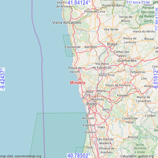
Mindelo GPS coordinates[2]
41° 18' 54.972" North, 8° 43' 16.464" West
| Map corner | latitude | longitude |
|---|---|---|
| Upper-left | 41.84124°, | -9.42437° |
| Center: | 41.31527°, | -8.72124° |
| Lower-right: | 40.78502°, | -8.01812° |
| Map W x H: | 117.4×117.4 km | = 72.9×72.9mi |
| max Lat: | 42.11337° ⇑16.1% North |
| Mindelo: | 41.31527° |
| min Lat: | ⇓83.9% South 32.6448° |
| min Long | Mindelo | max Long |
| -31.17847° | -8.72124° | -6.27308° |
| W 36%⇐ | ⇒64% E |
Elevation
Elevation of Mindelo is 30 m = 98 ft, and this is 147 m = 482 ft below average elevation for this country.
| Max E: |
1008 m = 3307 ft | 81.8% |
| Avg. | 177 m = 581 ft | |
| Mindelo | 30 m = 98 ft | |
Min E: |
-128 m = -420 ft | 18.2% |
See also: Portugal elevation on elevation.city.
Geographical zone
Mindelo is located in North temperate zone (between Tropic of Cancer and the Arctic Circle). Distance of this Northern Tropic circle is 1987.9 km =1235.2 mi to South.| Distance of | km | miles | from Mindelo |
|---|---|---|---|
| North Pole | 5413.2 | 3363.6 | to North |
| Arctic Circle | 2807.3 | 1744.4 | to North |
| Tropic Cancer | 1987.9 | 1235.2 | to South |
| Equator | 4593.8 | 2854.5 | to South |


Nearby cities:
15 places around Mindelo: (largest is in red/bold)
• Amorim
10.3 km =6.4 mi,  346°
346°
• Anta
9.5 km =5.9 mi,  125°
125°
• Arcos
10.1 km =6.3 mi,  26°
26°
• Argivai
7 km =4.3 mi, 354°
• Aver-o-Mar
11.2 km =7 mi,  334°
334°
• Beiriz de Baixo
9.1 km =5.7 mi,  358°
358°
• Gemunde
8.3 km =5.2 mi, 129°
• Lavra
6.2 km =3.9 mi,  177°
177°
• Moreira
9.7 km =6 mi,  140°
140°
• Pedroso
10.9 km =6.8 mi, 347°
• Póvoa de Varzim
8.4 km =5.2 mi, 334°
• Rio Mau
10.5 km =6.5 mi,  19°
19°
• Vairão
5 km =3.1 mi,  66°
66°
• Vila do Conde
4.7 km =2.9 mi, 334°
• Árvore
2.7 km =1.7 mi,  5°
5°
Sources, notices
• [Note1] Compared only with cities in Portugal existing in our database
• [Src1] Map data: © OpenStreetMap contributors (CC-BY-SA)
• [Src2] Other city data from geonames.org with taken over terms of usage.
• [Src3] Geographical zone / Annual Mean Temperature by Robert A. Rohde @ Wikipedia
