Figueira da Foz geodata
Figueira da Foz (Coimbra) is a seat of a second-order administrative division; located in Portugal in Europe/Lisbon (GMT+1) time zone. With population of 46,600 people, there are 23 cities with bigger population in this country. Compared to other cities in Portugal, 54.8% of cities are located further ↓South; 70.4% of cities are located further →East and 91.2% of cities have higher elevation than Figueira da Foz. Note1
Administrative division(s):
- Level 1: Coimbra
- Level 2: Figueira da Foz
- Level 3: São Julião da Figueira da Foz


Figueira da Foz GPS coordinates[2]
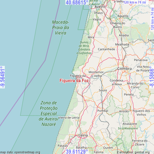
40° 9' 3.06" North, 8° 51' 42.444" West
| Map corner | latitude | longitude |
|---|---|---|
| Upper-left | 40.68615°, | -9.56491° |
| Center: | 40.15085°, | -8.86179° |
| Lower-right: | 39.61129°, | -8.15866° |
| Map W x H: | 119.5×119.5 km | = 74.3×74.3mi |
| max Lat: | 42.11337° ⇑45.2% North |
| Figueira da Foz: | 40.15085° |
| min Lat: | ⇓54.8% South 32.6448° |
| min Long | Figueira da Foz | max Long |
| -31.17847° | -8.86179° | -6.27308° |
| W 29.6%⇐ | ⇒70.4% E |
Elevation
Elevation of Figueira da Foz is 15 m = 49 ft, and this is 162 m = 531 ft below average elevation for this country.
| Max E: |
1008 m = 3307 ft | 91.2% |
| Avg. | 177 m = 581 ft | |
| Figueira da Foz | 15 m = 49 ft | |
Min E: |
-128 m = -420 ft | 8.8% |
See also: Figueira da Foz elevation on elevation.city.
Geographical zone
Figueira da Foz is located in North temperate zone (between Tropic of Cancer and the Arctic Circle). Distance of this Northern Tropic circle is 1858.4 km =1154.8 mi to South.| Distance of | km | miles | from Figueira da Foz |
|---|---|---|---|
| North Pole | 5542.7 | 3444.1 | to North |
| Arctic Circle | 2936.8 | 1824.8 | to North |
| Tropic Cancer | 1858.4 | 1154.8 | to South |
| Equator | 4464.4 | 2774 | to South |


Nearby cities:
15 places around Figueira da Foz: (largest is in red/bold)
• Alfarelos
17.7 km =11 mi,  90°
90°
• Alhadas
7.2 km =4.5 mi,  57°
57°
• Ançã
31.9 km =19.8 mi,  65°
65°
• Arazede
23.5 km =14.6 mi,  50°
50°
• Buarcos
2.1 km =1.3 mi,  322°
322°
• Cantanhede
31.5 km =19.6 mi, 46°
• Carapinheira
19.2 km =11.9 mi, 71°
• Condeixa-a-Nova
31.2 km =19.4 mi,  97°
97°
• Lavos
7 km =4.3 mi,  155°
155°
• Louriçal
19.5 km =12.1 mi,  147°
147°
• Monte Redondo
28.1 km =17.5 mi,  174°
174°
• Montemor-o-Velho
15.1 km =9.4 mi,  80°
80°
• Soure
22.5 km =14 mi,  116°
116°
• Tavarede
2.3 km =1.4 mi,  37°
37°
• Tocha
20.2 km =12.6 mi,  27°
27°
Sources, notices
• [Note1] Compared only with cities in Portugal existing in our database
• [Src1] Map data: © OpenStreetMap contributors (CC-BY-SA)
• [Src2] Other city data from geonames.org with taken over terms of usage.
• [Src3] Geographical zone / Annual Mean Temperature by Robert A. Rohde @ Wikipedia
