Valenzuela geodata
Valenzuela (Cordillera) is a populated place; located in Paraguay in America/Asuncion (GMT-4) time zone. With population of 587 people, there are 158 cities with bigger population in this country. Compared to other cities in Paraguay, 55.6% of cities are located further ↑North; 59.3% of cities are located further →East and 68.5% of cities have lower elevation than Valenzuela. Note1


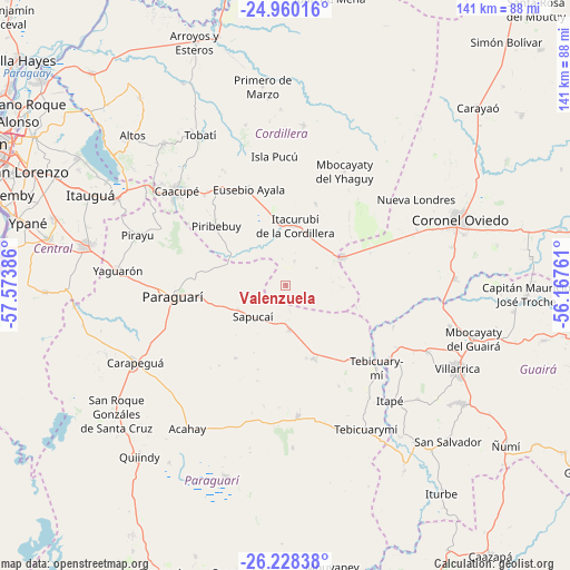
Valenzuela GPS coordinates[2]
25° 35' 45.42" South, 56° 52' 14.628" West
| Map corner | latitude | longitude |
|---|---|---|
| Upper-left | -24.96016°, | -57.57386° |
| Center: | -25.59595°, | -56.87073° |
| Lower-right: | -26.22838°, | -56.16761° |
| Map W x H: | 141×141 km | = 87.6×87.6mi |
| max Lat: | -19.91667° ⇑55.6% North |
| Valenzuela: | -25.59595° |
| min Lat: | ⇓44.4% South -27.38662° |
| min Long | Valenzuela | max Long |
| -60.78333° | -56.87073° | -54.30694° |
| W 40.7%⇐ | ⇒59.3% E |
Elevation
Elevation of Valenzuela is 183 m = 600 ft, and this is 13.3 m = 44 ft above average elevation for this country.
| Max E: |
658 m = 2159 ft | 31.5% |
| Valenzuela | 183 m 600 ft | |
| Avg. | 169.7 m = 557 ft | |
Min E: |
46 m = 151 ft | 68.5% |
See also: Paraguay elevation on elevation.city.
Geographical zone
Valenzuela is located in South temperate zone (between Tropic of Capricorn and the Antarctic Circle). Distance of this Southern Tropic circle is 240.1 km =149.2 mi to North.| Distance of | km | miles | from Valenzuela |
|---|---|---|---|
| Equator | 2846 | 1768.4 | to North |
| Tropic Capricorn | 240.1 | 149.2 | to North |
| Antarctic Circle | 4555.2 | 2830.5 | to South |
| South Pole | 7161.1 | 4449.7 | to South |


Nearby cities:
15 places around Valenzuela: (largest is in red/bold)
• Caacupé
35.9 km =22.3 mi,  310°
310°
• Coronel Martínez
31.2 km =19.4 mi,  125°
125°
• Eusebio Ayala
25.4 km =15.8 mi,  339°
339°
• Félix Pérez Cardozo
38.5 km =23.9 mi,  114°
114°
• Isla Pucú
32.1 km =19.9 mi,  354°
354°
• Itacurubí de la Cordillera
15 km =9.3 mi,  6°
6°
• Itapé
38.4 km =23.9 mi,  137°
137°
• La Colmena
32.4 km =20.1 mi,  174°
174°
• Paraguarí
27.9 km =17.3 mi,  264°
264°
• Pirayú
38.6 km =24 mi,  288°
288°
• Piribebuy
22.5 km =14 mi, 310°
• San José
15.4 km =9.6 mi,  63°
63°
• Santa Elena
21.6 km =13.4 mi,  19°
19°
• Sapucaí
11.3 km =7 mi,  226°
226°
• Ybytymi
19.3 km =12 mi,  159°
159°
Sources, notices
• [Note1] Compared only with cities in Paraguay existing in our database
• [Src1] Map data: © OpenStreetMap contributors (CC-BY-SA)
• [Src2] Other city data from geonames.org with taken over terms of usage.
• [Src3] Geographical zone / Annual Mean Temperature by Robert A. Rohde @ Wikipedia
