San Pablo de Ycuámandyyú geodata
San Pablo de Ycuámandyyú (San Pedro) is a populated place; located in Paraguay in America/Asuncion (GMT-4) time zone. With population of 659 people, there are 155 cities with bigger population in this country. Compared to other cities in Paraguay, 85.8% of cities are located further ↓South; 66.7% of cities are located further →East and 91.4% of cities have higher elevation than San Pablo de Ycuámandyyú. Note1
Current local time in San Pablo de Ycuámandyyú:
05:31 PM, ThursdayDifference from your time zone: hours


San Pablo de Ycuámandyyú GPS coordinates[2]
24° 9' 0" South, 57° 4' 0.012" West
| Map corner | latitude | longitude |
|---|---|---|
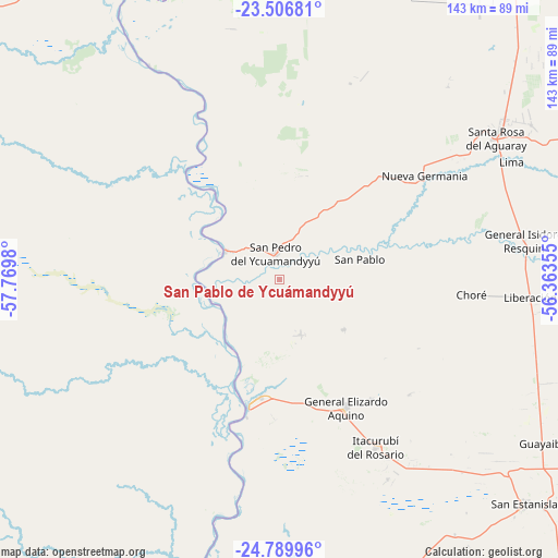
| Upper-left | -23.50681°, | -57.7698° |
| Center: | -24.15°, | -57.06667° |
| Lower-right: | -24.78996°, | -56.36355° |
| Map W x H: | 142.7×142.7 km | = 88.7×88.7mi |
| max Lat: | -19.91667° ⇑14.2% North |
| San Pablo de Ycuámandyyú: | -24.15° |
| min Lat: | ⇓85.8% South -27.38662° |
| min Long | San Pablo de Yc | max Long |
| -60.78333° | -57.06667° | -54.30694° |
| W 33.3%⇐ | ⇒66.7% E |
Elevation
Elevation of San Pablo de Ycuámandyyú is 78 m = 256 ft, and this is 91.7 m = 301 ft below average elevation for this country.
| Max E: |
658 m = 2159 ft | 91.4% |
| Avg. | 169.7 m = 557 ft | |
| San Pablo de Ycuámandyyú | 78 m = 256 ft | |
Min E: |
46 m = 151 ft | 8.6% |
See also: Paraguay elevation on elevation.city.
Geographical zone
San Pablo de Ycuámandyyú is located in South temperate zone (between Tropic of Capricorn and the Antarctic Circle). Distance of this Southern Tropic circle is 79.3 km =49.3 mi to North.| Distance of | km | miles | from San Pablo de Ycuámandyyú |
|---|---|---|---|
| Equator | 2685.2 | 1668.5 | to North |
| Tropic Capricorn | 79.3 | 49.3 | to North |
| Antarctic Circle | 4715.9 | 2930.3 | to South |
| South Pole | 7321.8 | 4549.6 | to South |


Nearby cities:
15 places around San Pablo de Ycuámandyyú: (largest is in red/bold)
• Antequera
15.5 km =9.6 mi,  297°
297°
• Belén
78.6 km =48.8 mi,  345°
345°
• Chore
49.3 km =30.6 mi,  94°
94°
• Colonia Nueva Germania
45.6 km =28.3 mi,  54°
54°
• Concepción
91.3 km =56.7 mi,  335°
335°
• General Elizardo Aquino
36.8 km =22.9 mi,  152°
152°
• Guayaybi
77 km =47.8 mi,  123°
123°
• Horqueta
89.8 km =55.8 mi,  0°
0°
• Itacurubí del Rosario
49.4 km =30.7 mi, 150°
• Lima
66.4 km =41.3 mi,  63°
63°
• Puerto Rosario
33.3 km =20.7 mi,  193°
193°
• San Pedro de Ycuamandiyú
7.5 km =4.7 mi, 343°
• Tacuatí
92.1 km =57.2 mi,  32°
32°
• Unión
91.6 km =56.9 mi,  142°
142°
• Veinticinco de Diciembre
80.5 km =50 mi, 139°
Sources, notices
• [Note1] Compared only with cities in Paraguay existing in our database
• [Src1] Map data: © OpenStreetMap contributors (CC-BY-SA)
• [Src2] Other city data from geonames.org with taken over terms of usage.
• [Src3] Geographical zone / Annual Mean Temperature by Robert A. Rohde @ Wikipedia
