San Isidro de Curuguaty geodata
San Isidro de Curuguaty (Canindeyú) is a populated place; located in Paraguay in America/Asuncion (GMT-4) time zone. With population of 11,095 people, there are 30 cities with bigger population in this country. Compared to other cities in Paraguay, 83.3% of cities are located further ↓South; 80.9% of cities are located further ←West and 78.4% of cities have lower elevation than San Isidro de Curuguaty. Note1
Current local time in San Isidro de Curuguaty:
04:01 PM, ThursdayDifference from your time zone: hours


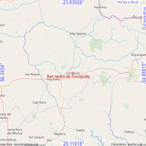
San Isidro de Curuguaty GPS coordinates[2]
24° 28' 18.624" South, 55° 41' 32.172" West
| Map corner | latitude | longitude |
|---|---|---|
| Upper-left | -23.83026°, | -56.3954° |
| Center: | -24.47184°, | -55.69227° |
| Lower-right: | -25.11016°, | -54.98915° |
| Map W x H: | 142.3×142.3 km | = 88.4×88.4mi |
| max Lat: | -19.91667° ⇑16.7% North |
| San Isidro de Curuguaty: | -24.47184° |
| min Lat: | ⇓83.3% South -27.38662° |
| min Long | San Isidro de C | max Long |
| -60.78333° | -55.69227° | -54.30694° |
| W 80.9%⇐ | ⇒19.1% E |
Elevation
Elevation of San Isidro de Curuguaty is 215 m = 705 ft, and this is 45.3 m = 149 ft above average elevation for this country.
| Max E: |
658 m = 2159 ft | 21.6% |
| San Isidro de Curuguaty | 215 m 705 ft | |
| Avg. | 169.7 m = 557 ft | |
Min E: |
46 m = 151 ft | 78.4% |
See also: Paraguay elevation on elevation.city.
Geographical zone
San Isidro de Curuguaty is located in South temperate zone (between Tropic of Capricorn and the Antarctic Circle). Distance of this Southern Tropic circle is 115.1 km =71.5 mi to North.| Distance of | km | miles | from San Isidro de Curuguaty |
|---|---|---|---|
| Equator | 2721 | 1690.8 | to North |
| Tropic Capricorn | 115.1 | 71.5 | to North |
| Antarctic Circle | 4680.2 | 2908.1 | to South |
| South Pole | 7286 | 4527.3 | to South |


Nearby cities:
15 places around San Isidro de Curuguaty: (largest is in red/bold)
• Capiíbary
50.2 km =31.2 mi,  223°
223°
• Cecilio Baez
86.9 km =54 mi, 219°
• Chore
95.6 km =59.4 mi,  289°
289°
• Colonia Minga Porá
91.3 km =56.7 mi,  118°
118°
• Corpus Christi
87.9 km =54.6 mi,  60°
60°
• Guayaybi
75.3 km =46.8 mi,  264°
264°
• Itakyry
79.2 km =49.2 mi,  136°
136°
• Mbutuý
83.8 km =52.1 mi,  228°
228°
• Nueva Esperanza
84.8 km =52.7 mi,  92°
92°
• San Joaquín
71.3 km =44.3 mi,  209°
209°
• Unión
91.8 km =57 mi,  245°
245°
• Veinticinco de Diciembre
90.4 km =56.2 mi, 253°
• Yataity del Norte
77.7 km =48.3 mi,  238°
238°
• Ygatimi
39 km =24.2 mi,  7°
7°
• Yhú
69.2 km =43 mi,  199°
199°
Sources, notices
• [Note1] Compared only with cities in Paraguay existing in our database
• [Src1] Map data: © OpenStreetMap contributors (CC-BY-SA)
• [Src2] Other city data from geonames.org with taken over terms of usage.
• [Src3] Geographical zone / Annual Mean Temperature by Robert A. Rohde @ Wikipedia
